Introduction
This compact guide packages field-ready A0 maps, clean GeoJSON/KML/GPX layers, vetted GPX routes, and a strict fossil-ethics protocol into a single, practical toolkit for safe work and travel in the Mongolian Gobi. It covers the full range of terrain — from the dunes at Khongoryn Els to the badlands of Bayanzag (Flaming Cliffs) and the research-rich strata of the Nemegt Formation — and focuses on reliable navigation, verifiable files, and protecting sensitive sites.
Why this page exists — the simple promise
Many online pages about the Gobi excel at one thing: stunning photography, rigorous palaeontology, or personal travel narratives. Few combine those strengths into a practical, downloadable pack that a field team, independent traveller, or local researcher can actually use.
This page promises:
- High-resolution A0 printable maps with lat/long grid and professional layout guidance.
- Clean, modular GeoJSON layers and a single KML overview for Google Earth users.
- Curated GPX files for self-drive routes and day loops with fuel, water, and camp waypoints.
- A clear README with SHA256 checksums and a license that protects sensitive data and prohibits misuse.
- Practical route-planning resources — contingency fuel and water planning, vehicle-recovery checklists, comms recommendations, and recovery techniques for dunes and soft sand.
- Strong fossil-ethics rules: coarse, view-only fossil polygons rather than precise point coordinates; explicit “do not collect” guidance and local-authority reporting instructions.
Why this matters: the Mongolian Gobi contains globally important fossil beds. In the past decades, illegal extraction and smuggling have damaged scientific heritage. Responsible map authorship and careful dissemination reduce the risk of harm while still enabling legitimate research and safe tourism.
Quick facts & single-line references
- Area: The Gobi Desert spans roughly 1.29 million km² (~500,000 sq mi) across southern Mongolia and northern China; the Mongolian portion includes extensive dunes, badlands, and dry river basins.
- Climate: Cold desert — strong diurnal swings; hot daytime temperatures in summer and very cold winters.
- Paleontology: Home to world-famous fossil sites (Flaming Cliffs / Bayanzag; Nemegt Basin). Ongoing research and the history of illicit collecting underscore the importance of fossil ethics.
Overview and location — where in the world?
The Gobi is not a single, homogeneous sand sea. The Mongolian portion contains dune fields, badlands carved from red sandstone, river-cut basins that host fossiliferous strata, intermittent wetlands, and steppe pockets. Much of the Landscape sits high — often between 900 and 1,500 meters above sea level — which gives the region its distinctive cold-desert climate: hot days, brisk nights, and seasonally severe winters.
Key places you should know (each named here once — they will be mentioned later in plain text):
- Khongoryn Els
- Bayanzag (Flaming Cliffs)
- Nemegt Formation
- Yol Valley
- Gobi Gurvan Saikhan National Park
- Dalanzadgad
(From here on, I will refer to those places in plain text without the entity wrapper.)
The diversity of terrain — from towering dunes to flinty regs and green river cuts — means you must plan for vastly different ground conditions in a single route.
Landscape features — what you’ll see
Expect a surprising variety:
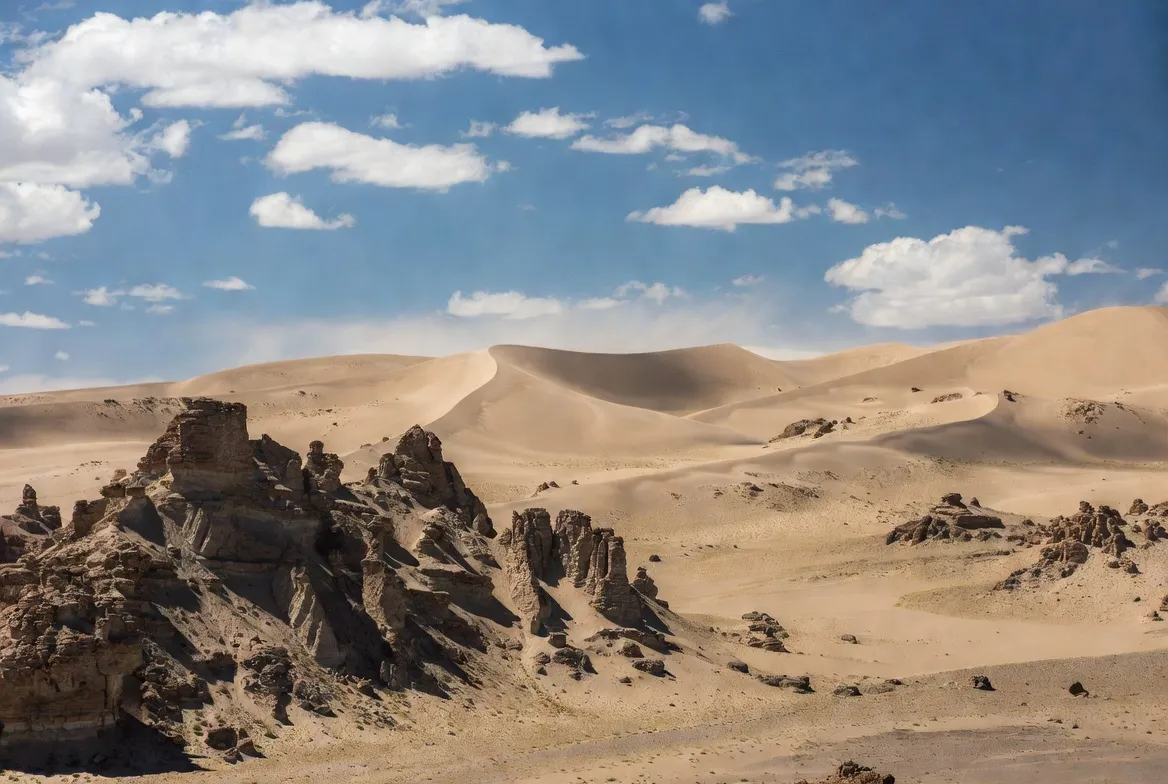
- Dunes — large fields like Khongoryn Els that range from gentle sheet dunes to steep star dunes. Dunes are spectacular but deceptively challenging for vehicles; sand traps and soft ramps are common.
- Red sandstone cliffs and badlands — Bayanzag, also known as the Flaming Cliffs, is a classic example: richly colored outcrops with historically important palaeontological finds.
- River valleys and seasonal wetlands — places like the Nemegt Basin have greener pockets and seasonal flow, supporting birds and nomadic herders.
- Stony desert (reg) and salt pans — wide, firm expanses of small rock and salt that are usually drivable at moderate speeds but can hide soft patches and ruts.
What’s in the Gobi Desert (Mongolia) — Map Pack
A professional package should include the downloadable files below, accompanied by a concise README file that explains checksums and licensing. The pack is designed for practical use in the field while minimizing the risk of enabling harmful activity.
Core files
- A0 300 DPI printable PDF — single-sheet print-ready PDF, CMYK (for professional print shops) or sRGB with bleed, crop marks, and a lat/long tic/grid. Include a clearly readable legend and a north arrow. Provide both a full-color and a high-contrast black-and-white variant for different lighting and printing conditions.
- A0 tiled PDF ZIP — set of tiled pages for home/office printing. Include foil-overlap instructions and a simple visual guide for aligning tiles.
- geojson/ — modular vector directory with separate, well-documented GeoJSON files for:
- roads/tracks (line features; include source and date)
- services (fuel stations, repair shops, basic medical points)
- campsites & ger-stays (points with attributes: owner, phone, reliability)
- water sources (wells, springs) with quality and verification notes
- protected areas/park boundaries (polygons with authority and permit info)
- view-only fossil polygons (generalized polygons, not points)
- kml_overview.kml — single convenience KML for Google Earth that aggregates the most important layers (with fossil layers set to view-only).
- gpx/ — curated GPX routes (easy/moderate/hard) with named waypoint attributes for fuel, water, camp, and hazards.
- icons/svg/ — open-source scalable icon set for map symbology, optimized for A0 printing.
- README.md — usage notes, license, fossil-ethics, and SHA256 checksum instructions.
- checksums.txt — sha256 hashes for every file so users can verify downloads before relying on them.
Why include view-only polygons for fossils?
Precise coordinates in public files make illegal collection both easier and more lucrative. To reduce that risk:
- Use generalized polygons that indicate a general area without pinpointing bed-level coordinates.
- Mark fossil layers as view-only by default and explain how legitimate researchers can request access to point-level data through authenticated, documented institutional channels.
- Include a short, explicit protocol in the README: “If you find bones: photograph, note approximate area, and contact local authorities. Do NOT remove fossils.”
This approach balances scientific transparency with protective stewardship.
How to use the GIS files — simple steps
For QGIS
- Open QGIS → Layer → Add Vector Layer → load the GeoJSON files.
- Use the attribute tables to filter and style by category (fuel, camp, spring, protected area).
- Add raster elevation tiles (SRTM) or offline tile XYZ for context.
- Use the print layout to export the map to A0 PDF at 300 DPI; check color profiles (CMYK for print shops) before exporting.
For Google Earth
- Open the KML to inspect overlays and satellite imagery; use folder visibility to hide fossil polygons unless you are an authorized researcher.
Mobile apps
- Import GPX routes into your app.
- Pre-download offline tiles for the areas you’ll visit.
- Use both electronic navigation and a paper A0 or tiled printout as a backup.
5 Curated GPX Routes — summary and how to pick
These sample routes are designed to be practical starting points; each route in the pack includes a GPX file, an elevation profile PNG, daily mileage, fuel plan, and waypoints for fuel, water, and camps. Times and distances are approximate — verify locally.
| Route | Approx km | Days | Difficulty | Highlights |
| Khongoryn Els loop | 120–250 | 2–3 | Easy–Moderate | Dunes, camel rides, gers |
| Bayanzag → Nemegt loop | 200–350 | 3–4 | Moderate | Flaming Cliffs, fossil-area views |
| Yol Valley day loop | 40–80 | 1–2 | Easy | Hiking, raptors, cool gorge |
| Self-drive steppe corridor | 600–900 | 7–10 | Moderate–Hard | Ger stays, diverse landscapes |
| Ejin rim/rock photography loop | 200–400 | 3–5 | Hard | Remote rock formations |
Each route file in the full pack should include:
- GPX file with named waypoints.
- Elevation profile PNG and a small route map thumbnail.
- Daily mileage, expected driving times, and fuel plan with contingency margins.
- Waypoint attributes: fuel reliability, water reliability, camp suitability, hazard notes.
Route planning checklist
Before you leave
- Vehicle: high-clearance 4×4; spare tyres (two recommended), tyre repair kit, and a kit of essential spares (belts, hoses).
- Fuel: carry at least +30% contingency beyond planned consumption. Mark fuel stations and plan for caches if necessary.
- Water: carry water for at least +30% contingency. Treat well-sourced water and confirm sources on arrival.
- Recovery: winch, snatch straps, shackles, shovel, sand ladders or traction mats, high-lift jack.
- Comms: satellite phone or emergency beacon (InReach or Spot), plus a local SIM and data plan for towns.
- Maps: offline tiles for your phone and at least one printed A0 map or tiled print set with lat/long grid.
- Permissions: permits for research and protected-area entry; copies of vehicle registration and passport.
- Local contact: phone numbers for Dalanzadgad resources, your ger host, or a local guide.
- Weather: obtain recent forecasts and seasonal advice; wind and sudden precipitation can change track passability quickly.
Driving tips for dunes and soft sand
- Reduce tyre pressure before entering dunes (start around 20–25 psi and adjust according to load).
- Use low-range gearing and maintain momentum in soft sand; avoid abrupt braking or steering.
- If you get stuck: reduce tyre pressure, use sand ladders or traction mats, dig out under tyres if necessary, and avoid wheel spin — that worsens the rut.
- Travel during cooler parts of the day when possible and monitor tyre and engine temperature.
- Cross-check the GPS with the printed map and observed landmarks: dunes move, and tracks can be misleading.
Conservation & fossil-ethics — non-negotiable
The Mongolian Gobi holds some of the richest dinosaur fossil localities on earth. Over decades, both commercial and opportunistic collecting have degraded scientific value and cultural patrimony. A responsible map pack is part of the solution.
Practical rules for map-pack authors and users
- Generalize fossil locales — use polygons and approximate zones, never point-level public coordinates.
- View-only layers — mark fossil layers as view-only and provide contact channels for legitimate researchers to request access to detailed data.
- README ethics statement — include firm language: “If you find bones: photograph, note approximate area (without disturbing context), and inform local authorities. Do NOT remove fossils.”
- Licensing — adopt a non-commercial research & personal-use license that explicitly forbids commercial sale of sensitive location data and requires removal of any precise fossil points before redistribution.
- Support local institutions — provide donation links and recommended partnerships with Mongolian museums or research groups.
- Report and cooperate — encourage reporting suspicious activity to local officials and to national-level heritage bodies.
International reporting and investigations have repeatedly shown that illicit fossil trafficking is a live concern. Map authors must design datasets that enable legitimate use while closing off easy misuse.
Legal notes and permitting
- Removing fossils without appropriate permission is illegal. If your plans include paleontological fieldwork, obtain formal permits from Mongolian institutions and national authorities.
- National parks and protected areas often have fees, access rules, and restricted zones. Verify the rules for Gobi Gurvan Saikhan and any other managed areas you intend to enter.
- Photographs for personal use are generally allowed, but removal of artifacts or bones is prohibited.
- If you are an institution planning excavations, maintain formal agreements and local partnerships, and ensure finds remain in accordance with Mongolian cultural heritage laws.
How we built the pack — short methodology
- Base imagery: satellite sources for high-resolution background matching (public and licensed imagery) and SRTM for elevation.
- Tracks & verification: compiled from field-verified tracks where possible, cross-checked against recent high-resolution satellite images and local reports.
- Services: aggregated from local sources and traveler/driver reports with date stamps and reliability notes. Mark all services as dynamic — verify on arrival.
- Fossil polygons: created from public scientific literature and intentionally generalized to avoid precise localities; polygons are conservative and do not replicate excavation-level points.
Technical tips for authors — QGIS quick styling cheatsheet
- Use a category attribute to style point layers (fuel, water, camp, medical).
- Set a consistent symbol size for A0 printing and test legibility at 1m/px map scale.
- Export the A0 PDF at 300 DPI; if sending to a print shop, export in CMYK and include bleed and crop marks.
- Add a lat/long grid (choose 1° or 30′ spacing by scale), north arrow, scale bar, and an inset locator map.
- Include a full legend with icon samples from the SVG set and an explanatory note on fossil layer restrictions.

Example README snippet
README — Gobi Pack v1.0
Files: gobi_pack_a0.pdf, gobi_geojson_roads.geojson, gobi_kml_overview.kml, routes/*.gpx, icons/svg/
Checksums: Use sha256sum <filename> and compare to checksums.txt.
Fossil ethics: Fossil locations are generalized polygons only. Do not remove, buy, or sell fossils. Report finds to local authorities and museum contacts listed in the contacts.txt file.
License: Non-commercial research & personal use only. Redistribution must remove sensitive fossil point data.
Support: Consider donating to local museums or conservation funds; contact info in CONTRIBUTORS.md.
Verify on Linux/macOS:
sha256sum gobi_pack_a0.pdf
# compare printed hash to checksums.txt
Verify on Windows (PowerShell):
Get-FileHash gobi_pack_a0.pdf -Algorithm SHA256
Sample GPX & README commands
- GPX files include attributes in the waypoint name fields: FUEL_OK / FUEL_MAYBE / FUEL_NONE; WATER_OK / WATER_VERIFY; CAMP_OK / CAMP_PREV_BOOKED.
- Elevation profiles are PNGs generated from the GPX track with an approximate sample interval — use them as planning references, not precise field altimetry.
Practical field advice — survival and comfort
- Expect large thermal shifts: bring layered clothing, UV protection, and a sleeping bag rated for cold desert nights.
- First-aid kit should cover altitudinal issues, deep cuts, and infection control — carry antiseptics and wound-care supplies.
- Plan for two navigation methods: electronic (phone / GPS) and paper (A0/tiled prints).
- Know local customs and always ask before photographing private property or herders’ camps.
- For dune travel, consider hiring local drivers or a guide who knows soft-sand corridors and typical hazard areas.
Pros & Cons
Pros
- Accelerates planning with ready-to-import layers.
- Produces print-ready A0 maps for vehicle or base camp.
- Generalized fossil protection reduces legal/ethical risk.
- Curated GPX tracks save reconnaissance time.
Cons
- Static GPX files can become out-of-date; dunes and river courses shift.
- Generalized fossil polygons reduce excavation-level scientific utility.
- Relying only on GPX without local knowledge or recovery gear is dangerous.
Interesting facts
- Much of the Gobi is not sand: large stretches are stony desert (reg) or steppe.
- Average elevation in many parts of the Mongolian Gobi falls between approximately 900 and 1,500 meters.
- The Nemegt Basin remains a cornerstone of Late Cretaceous terrestrial research, and legitimate fieldwork continues to yield important discoveries when done in partnership with local institutions.
FAQs
A: No. GPX tracks are references only. They do not replace local knowledge, recovery gear, or permits. Always download offline tiles and carry a satellite beacon.
A: Yes. Use the single-file A0 PDF for professional printing. For home printers, use the tiled PDFs and follow the overlap instructions in the README.
A: Partially. For conservation and legal reasons, fossil localities are included only as generalized polygons or view-only layers with strong ethical instructions. Do not remove fossils.
A: Late spring (May–June) and early autumn (September–October) usually offer the best balance of temperatures and passable tracks.
Conclusion
Use the pack as a practical starting point — always verify checksums, update dynamic service data, and secure the permits you need before you go. Above all, respect local laws and heritage (including protected areas such as Gobi Gurvan Saikhan National Park), support local partners around hubs like Dalanzadgad, and prioritize fossil ethics so the Gobi’s scientific legacy endures.


