Introduction
Thar (Tharparkar) is a culturally rich, water-stressed desert region in southeastern Sindh whose growing coal economy raises complex social and environmental trade-offs. This compact guide combines practical travel advice, cultural notes, and an NLP/data-driven toolkit for reporters, policy makers, and researchers—plus recommended assets (maps, datasets, and monitoring KPIs) to support ethical, evidence-based reporting and planning.
Quick facts: Location, size & map
Human-readable facts
- Location: Tharparkar district, southeastern Sindh province, Pakistan; boundary contiguous with Rajasthan, India.
- Administrative HQ: Mithi.
- Major towns: Islamkot, Diplo, Chhachro, Nagarparkar.
- Population: ~1.7 million (approx. 2023 figures; verify current census or district estimates).
- Key themes: travel, culture, Thar coal, water scarcity, and development.
Suggested dataset schema
- place_id (string): canonical slug, e.g., PK-SDH-THARPAR-KAR
- name (string): human name
- type (enum): town | village | district | region | mine | temple
- lat (float), lon (float)
- population_estimate (int)
- date_estimate (date)
- sources (array of references)
- notes (text): e.g., cultural significance, facilities
Assets to publish with the article
- A3 printable map with district boundaries, main roads, Mithi, Islamkot, and Thar coalfields (vector PDF + PNG).
- Two-page “Thar Quick Facts” PDF (designed for reporters).
- GeoJSON of key polygons: administrative boundary, mines, power plants, and major roads.
- A small CSV with the town gazetteer (name, lat, lon, population estimate, notes).
Why Thar matters — human narrative and a computational framing
Tharparkar matters because it is simultaneously a vibrant cultural region and a location of resource pressures. The human story includes livestock herding, handicrafts, festivals, and a large interfaith community (notably a significant Hindu minority at the district level). The structural story includes constrained water resources, variable rainfall, and the rapid arrival of the extractive industry (lignite coal).
- Named Entity Recognition (NER): Extracting local entities (towns, wells, community organizations, projects such as SECMC).
- Relation extraction: Mapping relations like town — has — hospital, project — uses — water-source, or community — practices — embroidery.
- Event extraction and timeline building: Capturing droughts, monsoon events, mine openings, protests, or resettlement notices.
- Sentiment & framing analysis: Studying how different stakeholders (government, company, local leaders, NGOs) narrate “development” vs “risk”.
- Geotagged image classification: Using labeled imagery to monitor land-use change (e.g., dune stabilization, mine expansion).
- Information retrieval / semantic search: Letting journalists query the combined corpus for specific claims (e.g., “water-use plan Islamkot 2022”).
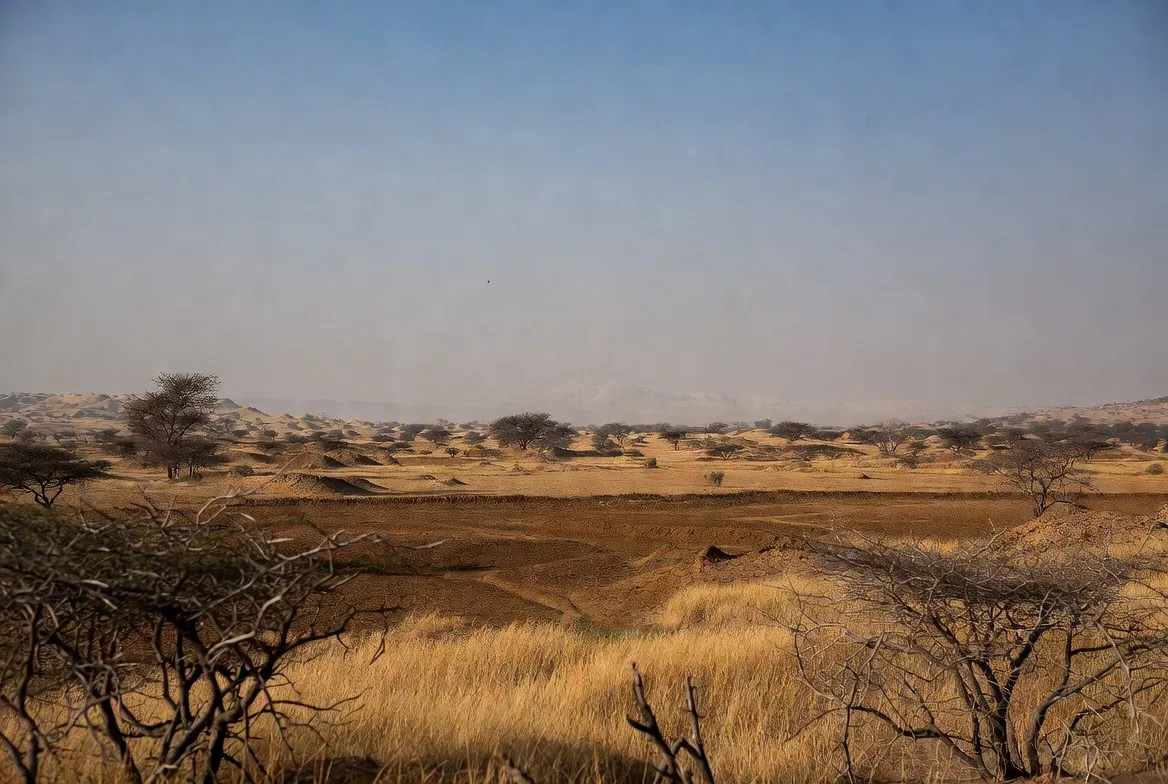
The land & climate: seasons, best visit time, and how to model seasonality
Climate overview (human): Hot and arid. Summers (April–June) are very hot. Winters (November–February) are mild and are the best visiting window. Most rainfall is received in the southwest monsoon as short, intense bursts. Periodic droughts and interannual variability characterize the area.
Best time to visit
- High season (Nov–Feb): cool and dry — best for travel.
- Shoulder (Mar–Apr, Sep–Oct): warm; mornings/evenings pleasant.
- Monsoon (Jul–Aug): spectacular greening, but road damage is possible.
- Low season (May–Jun): extreme heat — avoid daytime activity.
How to model seasonality in data:
- Usea time series of daily rainfall (convert to tokens of rain_event with attributes depth_mm, duration).
- Create binary greening labels derived from NDVI timeseries (satellite) to mark local vegetation pulses.
- Annotate road passability as categorical time-series: passable, seasonally_constrained, impassable.
These constructs make predictive models (e.g., which roads will be disrupted after a given rainfall threshold) easier to operationalize, and enable planners to map reliable access for humanitarian or tourism purposes.
Seasonal quick table
| Season | Typical conditions | Travel notes |
| Winter (Nov–Feb) | Mild, dry | Best time to visit |
| Spring (Mar–Apr) | Warming, dusty | Good mornings/evenings |
| Summer (May–Jun) | Extremely hot | Avoid daytime travel |
| Monsoon (Jul–Aug) | Rain bursts, greening | Spectacular but risky roads |
Their economy today: traditional livelihoods and the rise of coal
Traditional economy (human): Pastoralism (goats, sheep, camels), small-scale farming, and handicrafts (distinctive Thari embroidery and textiles). Market life is local; many livelihoods are informal.
Mining era (human): Large lignite deposits have spurred coal mining projects, investments in roads, and upgrades to local infrastructure such as the Islamkot airstrip. Companies and public authorities promise employment and regional development.
NLP/data framing — recommended indicators to gather and publish:
- household_income_breakdown (percentage): pastoralism | wage labor | crafts | remittances
- employment_by_sector (time-stamped)
- local_hiring_rate (percent of jobs filled by district residents in mining projects)
- land_acquisition_records (geo-tagged, with legal status and compensation details)
- water_allocation_registry (volume, source, permitted uses)
These indicators support fairness analyses (e.g., are jobs allocated to locals?) and environmental-resource trade-off models (how does water allocated to industry reduce household resilience?).
What the Thar coal projects aim to do
- Produce electricity using local lignite.
- Create jobs and local services.
- Reduce energy imports and bolster national supply.
Main concerns about coal projects
- Water demand: Coal operations require water for plant cooling and dust suppression. Data action: publish project_water_balance with sources (surface, groundwater, seawater desalinated).
- Resettlement: Mines may require land/relocation. Data action: a resettlement_tracker with coordinates, household counts, and compensation status.
- Health & dust: Track air_quality (PM2.5/PM10) at sentinel stations and health clinic admissions.
- Local benefits: Monitor contractor_hiring, apprenticeship_programs, and income_trajectories for affected communities.
Plain-English explainer: why Thar coal matters
Human summary: That coal is a large reserve of low-grade lignite. Locating generation near the resource reduces transport costs and brings infrastructure; that can help Pakistan’s grid and provide employment. But coal extraction and combustion are resource-intensive and polluting, and they may stress limited freshwater reserves and local livelihoods.
NLP-analogy explanation: Think of Thar as a large, noisy dataset. Lignite is a high-volume but lower-quality feature: useful, but requiring heavy preprocessing (water, dust control, emission mitigation) before it can be safely integrated into the “production model” (national energy mix). If the preprocessing removes resources needed by the training data (human livelihoods and water), model performance (human wellbeing) degrades. So the central question is about fair feature allocation: can we extract energy features without corrupting the integrity of local socio-ecological labels?
Key trade-offs
- Water as a scarce shared resource: plan allocation with hard constraints.
- Employment vs. displacement: weigh short-term job spikes against long-term land loss.
- Emissions and dust vs. local air quality: monitor with clear KPIs.
Water, health & development challenges
Water scarcity is arguably the defining development problem in Tharparkar. Households frequently rely on shallow brackish groundwater, intermittent tanker deliveries, or occasional treated water points. Droughts and monsoon variability compound this stress.
Why is water hard here?
- Saline aquifers: Many shallow wells are brackish; treatment is necessary before household use.
- Few deep wells: Access to freshwater aquifers is capital-intensive.
- Sparse settlements and poor roads: Distribution infrastructure is expensive per capita.
- Climate variability: Rainfall is episodic and unpredictable.
- Industrial demand: Mines and thermal plants may require large, continuous water volumes.
Health effects
- Elevated waterborne disease risk where safe water is absent.
- Malnutrition and worse child health outcomes during drought shocks.
- Time poverty for women and girls who fetch water, lose schooling, and income opportunities.
Data & monitoring actions recommended:
- Set up a water_point_registry with GPS, source type (tank, well, piped), salinity measure (TDS or EC), and last-tested date.
- Create household_water_security_surveys with indicators: days without sufficient water, time to fetch, and coping strategies.
- Install low-cost salinity sensors on representative wells and publish daily or weekly readings for transparency.
- Use satellite-derived proxies (soil moisture, NDVI) to forecast stress and target tanker allocations proactively.
What works
- Community-operated handpumps plus point-of-use filters.
- Small desalination plants fed by brackish wells or reverse-osmosis units at community hubs.
- Rainwater harvesting tanks are designed for seasonal capture and storage.
- Institutional rules that prioritize potable use over industrial use during shortages, and legally enforced water-use plans, are disclosed publicly.

What to see & do in Thar (Mithi, Nagarparkar, festivals, wildlife) — travel plus data tips
Highlights:
- Mithi: district capital — markets, simple hotels, and the best base for exploring.
- Nagarparkar: historic Jain temples, granite outcrops, and a rocky terrain that contrasts with dunes.
- Seasonal greening: after strong monsoon rains, the desert blooms.
- Crafts: intricate mirror-work embroidery and textiles that are regionally specific.
- Stargazing: low ambient light makes for excellent night skies.
Activities & data-minded hints for visitors:
- Visit markets in Mithi: with permission, photograph crafts and record artisan details (names, techniques) for an ethical digital catalog.
- Take guided village visits; consider participatory mapping exercises, where locals annotate important water points and grazing corridors on a printed map — these sketches can be digitized into GIS layers.
- Hike around Nagarparkar with a local guide and capture geotagged photos to document temple conservation status.
- If photographing people, always ask consent; if sharing online, use blur and anonymization when requested.
Responsible travel tip (human): Ask permission before photographing people. Dress respectfully and follow local customs.
Practical travel guide (getting there, safety, permits) — plus “route planning” as a graph problem
Getting there
- From Karachi: Road distances vary between ~300–425 km depending on the chosen route and stops. A high-clearance vehicle or 4×4 is recommended for remote stretches.
- By air: Islamkot has upgraded airstrip facilities; flight availability is subject to seasonal schedules — check local operators.
- Local transport: Limited public transport; hire local drivers or arrange guided tours.
Permits & safety
- Most tourist areas are accessible. Avoid mine sites and fenced/exclusion areas.
- Check local advisories; consult district administration if you plan to research near industrial sites.
- Carry water, sun protection, and a robust first-aid kit.
Route-planning as graph theory: treat towns and roads as nodes and edges, with edge weights reflecting passability, distance, and seasonal risk. Build a simple Dijkstra or A* planner for suggested itineraries that minimize exposure (time in heat) and maximize access to water points. For publishers, present a downloadable JSON of recommended routes labeled safe, seasonal, or remote.
Health & safety checklist:
- Up-to-date vaccinations.
- Medicines for common tropical issues and heat exhaustion.
- Travel insurance covering medical evacuation if visiting very remote zones.
Local food & accommodation
Accommodation: Guesthouses, government rest houses, and homestays in Mithi and Islamkot. Luxury options are rare. Homestays help local economies — always negotiate fair payments and agree on house rules upfront.
Food: Local diet is hearty: flatbreads, dairy (milk, yogurt, whey-based products), seasonal vegetables, and regional staples. If you have dietary restrictions, carry supplements and specific items because choices are limited in remote areas.
Cultural tip: Many meals have shared dishes; accept hospitality politely. If invited, small gifts (nuts, sugar, or packaged goods) are appreciated.
Flora & fauna
Plants: Xerophytic shrubs, acacias, drought-tolerant grasses; quick-flowering plants emerge post-rain.
Animals: Desert mammals (e.g., foxes, jackals), reptiles, and numerous resident and migratory birds. Peafowl and some passerines occur in pockets where food/water exist.
Conservation guidance: Encourage community-based grazing management plans, support afforestation in suitable microclimates, and fund native-species reintroductions only after local consultation.
Data action: Build a species_observation table: species, taxon_id, observer, lat, lon, date, photo_link, notes. Encourage citizen scientists to submit validated observations.
Human history and culture
Thar’s history is a tapestry of pastoral mobility and cross-border connections with Rajasthan. Nagarparkar and the surrounding areas hold temple ruins and granite formations that are significant for cultural heritage. Crafts — especially mirror-work embroidery and textiles — are both cultural expressions and economic products.
Cultural data suggestions:
- Create a cultural_asset_registry capturing: asset_id, name, type (temple, festival, craft), community_custodian, condition, lat, lon, and permissible use (photography rules).
- When documenting songs, oral narratives, and recipes, use ethical oral-history protocols: obtain informed consent, specify reuse permissions, and keep copies accessible to communities.

Survival tips and visitor challenges
- Water: Carry ample water (a conservative rule: at least 4 liters per adult per day in dry conditions).
- Heat: Avoid midday sun in summer; schedule travel early or late in the day.
- Roads: Use a 4×4 for many interior routes.
- Health: Know the location of Mithi district hospital; recognize that capacity is limited.
- Respect: Dress modestly and ask before photographing individuals and religious sites.
Interesting facts
- Tharparkar is notable for having one of Pakistan’s largest district-level Hindu populations.
- The desert can transition from parched to green within days after monsoon rains.
- Those coal reserves are considered among the largest lignite deposits in the subcontinent.
Environmental issues and conservation
Key issues: Water scarcity and salinity; land-use change from commons to industrial land; dust and air quality problems.
Operational solutions & monitoring suggestions:
- Prioritize potable water — publish potable_coverage maps and ensure first-responder allocations during drought.
- Protect grazing lands — map communal pastures and designate biodiversity refuges.
- Dust-control — pave critical haul roads, establish green belts, and use water-efficient dust suppression protocols (e.g., treated wastewater where safe).
- Resettlement and livelihoods — transparent resettlement_registry with independent audits and livelihood restoration plans.
- Independent monitoring — create a third-party environmental_dashboard showing air quality, groundwater levels, and dust complaints updated monthly.
KPIs to publish publicly
- daily_PM2.5 and daily_PM10 at sentinel stations.
- well_depth_change (monthly).
- number_of_households_resettled and median_compensation_delay.
- local_hiring_percentage in major projects.
Table: Traditional livelihoods vs. Mining-era economy
| Feature | Traditional livelihoods | Mining/energy era |
| Primary income | Pastoralism, small-scale farming, crafts | Salaried jobs, contractual work, service-sector growth |
| Land use | Communal grazing, seasonal use | Mine pits, haul roads, plant footprints, infrastructure lines |
| Water demand | Household & livestock | Industrial and plant cooling, dust suppression needs |
| Social impact | Community-based resilience | Resettlement pressure, demographic shifts, and new income streams |
| Environmental risk | Overgrazing, drought cycles | Dust, water stress, and permanent land alteration |
FAQs
Tharparkar is in the southeastern Sindh province. It borders Rajasthan in India. It includes towns such as Mithi and Islamkot.
Many areas are safe if you are respectful and follow local advice. Avoid mine sites and check local travel alerts. Travel with a local guide for remote places.
It is a series of mining and power projects using lignite coal found in Thar. The projects aim to create energy and jobs. They also cause concerns about water, resettlement, and the environment.
Much of the shallow groundwater is salty. Clean water is not always nearby. Droughts, weak infrastructure, and increased water use from industry make water access a big problem.
Conclusion
Tharparkar’s future depends on balancing local livelihoods, scarce water resources, and energy ambitions. Responsible development requires transparent data, community consent, and monitoring that put human well-being first—use the guide’s maps, KPIs, and ethical data practices to inform fair decisions.


