Introduction
The Thar Desert is also referred to as the Great Indian Desert and has the size spanning over northwestern India and southeast Pakistan, and is among the most unique landscapes in South Asia. To students, travelers, educators, and researchers, the precise and straightforward Thar Desert map is necessary in comprehending the boundaries, cities, climatic regions, dune systems, and human development. This paper is a practical, SEO-oriented resource on downloadable Thar Desert maps in SVG, PDF, and KML. It is a description of how to use layered maps to educate, plan travel, analyze GIS, publish-and with the identification of major cities, conservation sites, irrigation, and current environmental developments.
At a glance — quick facts
- Common name: Thar Desert (Great Indian Desert).
- Area: Varies by method — ecoregion polygons often cite ~264,000 km²; more conservative geomorphological definitions frequently use ~200,000 km². Be explicit about which polygon and source you publish.
- Countries: India (majority) and Pakistan (notably Sindh & Punjab provinces).
- Major urban access points: Jaisalmer, Bikaner, Jodhpur (India); Pakistani Thar/Cholistan areas in Sindh and Punjab.
- Key protected area: Desert National Park near Jaisalmer (~3,000 km²).
- Major engineered change: Indira Gandhi Canal — a large irrigation project that has measurably changed land use in western Rajasthan.
Why a good Thar Desert map matters
A precise map is more than a visual decoration. It is the working instrument for orientation, safety, planning, education, and research.
- Orientation & context: A map shows the interface between the dunes and the plains, the reach of dune belts, and where seasonal salt lakes appear.
- Safety & logistics: For travellers and field teams, marking reliable water sources, fuel points, hospitals, and road condition notes can be life-saving.
- Research & planning: Clear polygons and time-stamped layers allow conservationists to measure land-use change, irrigation expansion, or habitat conversion.
- Education: Teachers and students use printable, labeled A3 maps to explore topics from geomorphology to human geography.
- SEO & engagement: Offering multiple download formats (SVG for designers, KML for Google Earth, PDF for print) increases dwell time and shareability — both valuable for search performance.
Where is the Thar Desert? Boundaries, states & major towns.
The Thar sits in the northwestern corner of the Indian subcontinent. Most of the Thar lies inside Rajasthan (India) with peripheral areas extending into Gujarat, Haryana, and Punjab. On the Pakistani side, the desert occupies parts of Sindh and Punjab provinces. Natural boundaries to guide polygon drawing include the Indus plain to the west and the Aravalli hills to the southeast.
Major towns and waypoints to include on any useful Thar map:
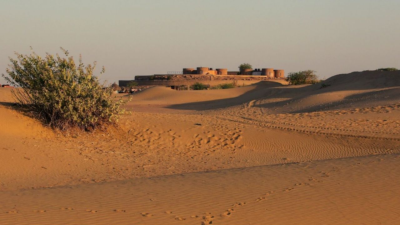
- Jaisalmer — western gateway to the Sam Sand Dunes and a common staging point for dune tours.
- Bikaner — an important historic and logistic hub in the north-central Thar.
- Jodhpur — major transport hub on the desert’s eastern edge; good rail/air connectivity.
- Barmer, Phalodi, Pokhran — useful waypoints and service towns for travelers and researchers.
Include town names at an appropriate scale and provide zoomed-in insets where towns cluster to improve legibility.
Climate & weather patterns
Climate type: Subtropical desert — hot summers, cool winters, and a short, often-variable monsoon (June–September).
Key mapable climate elements:
- Seasonal rainfall isohyets (show variation: western <100 mm/yr typical; eastern fringes higher in wet years).
- Average temperature bands (annual maxima/minima) for traveler planning.
- Monsoon closure overlay: roads and tracks prone to seasonal flooding.
Add a downloadable climate raster overlay (e.g., GeoTIFF or PNG with georeferencing) so GIS users can overlay precipitation or temperature layers in their analyses.
Landscape features to show on maps
A cartographically useful map distinguishes geomorphic elements and human land use:
- Erg/dune belts: mark where dunes are mobile (Sam Sand Dunes) versus stabilized or vegetated.
- Stony plains & rock outcrops: especially where the Thar abuts older platforms.
- Salt lakes/playas: Sambhar, Didwana, Pachpadra, and others — use dashed seasonal outlines.
- Interdunal valleys & stabilized dune fields: often the locations of villages and agriculture.
- Canals & irrigated patches: show where irrigation extends into formerly arid land.
Cartographic suggestion: Use distinct symbology for mobile vs stabilized dunes (e.g., sand-hatch vs stipple) and use dashed blue outlines for seasonal playas with the tag “seasonal — fills in wet years.”
Flora & fauna layers — conservation-aware mapping
Although the Thar might appear sparse at first glance, it hosts important plant communities and wildlife:
- Dominant plant communities: northwestern thorn scrub; key species include Prosopis cineraria (Khejri) and various Acacias — show dominant community polygons.
- Fauna to mark (map icons): chinkara (Indian gazelle), desert fox, and priority bird areas (notably Great Indian Bustard habitat).
- Conservation layers: Add GIB priority zones and flagged areas where mining or infrastructural development overlaps key habitat.
Cartographic note: Use an optional “biodiversity” layer that reduces detail at small scales and shows hotspots when users zoom in.
Human history, towns & culture — map boxes to enrich storytelling
Maps are not just terrain; they tell cultural and historical stories.
Historic and cultural features to map:
- Jaisalmer Fort and Bikaner palaces — include icons and short pop-up text or map boxes.
- Caravan routes and older pastoral corridors — mark seasonally used livestock trails and grazing commons.
- Land-use change overlays — show areas converted by irrigation or settlement expansion.
Adding small map boxes (insets) with historic scenes, a timeline of canal construction, or before/after satellite imagery increases engagement and makes the map shareable.
Survival tips & logistical map features for travellers
A practical Thar map must include a printable sidebar for travelers. Suggested content:
- Water & fuel points: mark with reliability flags (reliable/seasonal/unknown).
- Road conditions: paved/unpaved/seasonal washout.
- Healthcare: nearest district hospital and emergency numbers.
- Mobile network: an approximate overlay of telecom coverage.
- Driving guidance: suggested daily Driving distances, daylight-only travel notes.
Tourism: map-driven itineraries & KML tips
Embed route KML files for sample itineraries. Below is a short itinerary table you can paste into the page or wire into KML downloads:
| Itinerary | Day-by-day highlights | Map layers to enable |
| 1-day (Jaisalmer Express) | Jaisalmer Fort → Patwon Ki Haveli → Sam Sand Dunes sunset (drive ~45–70 km) | Cities, roads, dunes |
| 3-day (Dunes & Wildlife) | Day 1: Jaisalmer sightseeing; Day 2: Sam/Khuri dunes & camel stay; Day 3: Desert National Park & birding | Protected areas, waterholes, dune belts |
| 7-day (Heritage loop) | Jaisalmer → Khuri → Jodhpur → Bikaner → Return | Fuel points, tourist services, and historical sites |
KML tip: Offer “one-click” KML downloads for each itinerary and include pop-ups with driving times, fuel stops, and contact info for recommended guesthouses.
Interesting mapable curiosities
- The Thar is one of the most densely populated deserts in the world — villages are interspersed among dune fields and stabilized lands.
- Salt lakes like Sambhar are highly visible in satellite imagery and make excellent time-series classroom demos.
- The Indira Gandhi Canal is visible in satellite before/after comparisons and is a fantastic shareable slider example for story-based pages.
Recent developments that change the map
- Irrigation & greening: The Indira Gandhi Canal (IGNP) has transformed land use in parts of western Rajasthan. Add a canal overlay and provide a “greening since 1980” slider for visual impact.
- Conservation updates: Protected-area boundary adjustments, bustard conservation measures, and mining lease controversies all may change local management boundaries — include a “Recent changes” CMS feed.
- Greening drivers: Clarify that greening is driven by a combination of human interventions (irrigation, afforestation, urban expansion) and climate variability; add references to recent scientific literature in the CMS.
Environmental issues & cartographic needs
A responsible Thar map should make environmental risks visible:
- Groundwater depth & salinity: map groundwater tables and saline zones where data exists.
- Shifting sand encroachment: mark stabilized versus encroached croplands and note active stabilization projects.
- Threatened species & development threats: overlay GIB priority habitat and proposed mining/development polygons where possible, flagging conflicts.
Editorial suggestion: Add a transparency layer with dates and data sources, and update the “Last updated” date prominently on the page (e.g., Last updated: 2026-01-02).
Map layers and recommended symbology
| Layer | Purpose | Recommended display |
| That boundary polygon | define desert extent | bold dashed line + semi-transparent fill |
| State/province borders | political context | thin solid lines, labelled |
| Major cities & towns | travel & logistics | city icons sized by population |
| Dune belts (mobile vs fixed) | geomorphology | sand hatching vs stipple |
| Salt lakes/playas | seasonal water | blue dashed outlines with “seasonal” tag |
| Protected areas | conservation | shaded polygons + park name |
| Canals & irrigation | land-use change | blue ribbon with the year |
| Waterholes & wells | wildlife & survival | droplet icon + reliability flag |
| Roads & fuel points | route planning | highway vs local road symbology |
Pros & Cons
Pros
- Rich heritage and distinct mapable features (dunes, salt lakes, towns).
- Growing availability of open GIS datasets and KMLs for publishing.
- High search interest in downloadable maps (strong SEO potential).
Cons
- Water and road reliability data vary and need frequent updates.
- Political sensitivities exist along the India–Pakistan Boundary; use authoritative boundary sources.
- Environmental and irrigation projects change the mapped landscape quickly.
Accessibility & image metadata
Example alt & captions
- Alt: “Thar Desert locator map showing boundary across India and Pakistan.”
Caption: “Where the Thar Desert lies across Rajasthan (India) and Sindh/Punjab (Pakistan). Download a high-res PDF.” - Alt: “Detailed Thar Desert map with major cities Jaisalmer, Bikaner, and Jodhpur.”
Caption: “Major urban centres and road access points across the Thar — helpful for trip planning.” - Alt: “Map overlay showing Indira Gandhi Canal greening parts of the Thar.”
Caption: “Canal irrigation has changed land use across parts of the Thar — view the overlay in our map pack.”
Metadata & file accessibility: include title, description, language, license, and aria attributes for embedded maps. Provide plain-text transcripts of interactive map content for screen-reader users.

FAQs
A: Use the downloadable map pack on this page — thar-print-A3.pdf for classrooms and thar-boundary.svg for editable print work.
A: Yes. Most of the Thar lies in India (Rajasthan and parts of Gujarat, Haryana & Punjab); significant portions extend into Sindh and Punjab in Pakistan.
A: The Indira Gandhi Canal routed Himalayan river water into western Rajasthan, enabling irrigation, drinking water, and urban growth in places previously dry — this large engineered feature should be shown as a map overlay.
A: Yes — Desert National Park (~3,000 km²) near Jaisalmer is a major protected area; include its boundary KML in the map pack.
Conclusion
With the help of a Developed Map Pack on the Thar Desert, it converts complicated geography into a resource that can be used. With layered SVG, PDF, and KML downloads, scrupulously demarcated desert delimitation, and practical overlay (cities, canals, roads, and preserved areas), your map page can be considered authoritative and future-proof. Always keep files updated, sources clearr,,rnd updates visible, and your Thar Desert map guide will always have a place in classrooms, traveling, researching, and even search engines.


