Introduction
The largest hot desert in the world is the Sahara Desert, which occupies the North African region, marking the geography, climate and history of the region. It cuts across multiple nations, with a size of about 9 million square kilometres, and with massive dunes, rocky plateaus, oases, and cultural relics of ancient times. The description of the location, the size and significance of the Sahara is helpful in the comprehension of its applicability to the world, climate change and its effects on human life and modern travelling.
At a glance — quick facts
- Area: approximately 9.0-9.3 million km 2 (the largest hot desert on Earth; approximately 30-31 per cent of Africa).
- East–west span: ~4,800 km (≈ 3,000 miles).
- Typical precipitation cutoff (practical): often defined by regions receiving < 250 mm/year.
- Main landscape types: hamada (rocky plateaus), regs (gravel plains), ergs (sand seas), wadis (dry riverbeds), chotts/shatts (seasonal salt flats).
- Countries with major Sahara coverage: Algeria, Chad, Egypt, Libya, Mali, Mauritania, Morocco, Niger, Sudan, Tunisia, and Western Sahara.
- Best visitor bases/hubs: Merzouga (Morocco), Douz (Tunisia), Siwa (Egypt), Hoggar/Tassili n’Ajjer (Algeria), Nouakchott / Chinguetti (Mauritania).
- Typical interior rainfall: many sites < 50 mm/year; large areas under 250 mm/year.
- Common hazards: extreme heat, dehydration, flash floods in wadis, poor mobile coverage in remote areas, and local security instability in some regions.
Where is the Sahara on the map?
Sahara occupies the largest section of the north of Africa. It borders the Atlantic coast of Mauritania, and the western border of the disputed land of Western Sahara, to the east, the coasts of the Red Sea of Egypt and the Gulf of Suez. To the north, it fades away into the Mediterranean climate region (and olive-grove landscapes) of some parts of Morocco, Algeria, Tunisia, and Egypt, and to the south into the ecocline known as the Sahel, a semi-arid zone that separates the Sahara and the moister tropical Africa.
Practical mapping tips
- Use a GeoJSON polygon to provide an interactive Sahara overlay for Leaflet or Mapbox. Offer both a “core desert” polygon and a wider “transition zone” polygon to reflect variable definitions.
- Provide an SVG hero map for social sharing and to ensure a fast page load. Lazy-load raster tiles and allow users to toggle satellite/terrain layers.
- Include named place markers for key hubs (Merzouga, Douz, Siwa, Timbuktu, Chinguetti, Tamanrasset, Djanet, and Tassili n’Ajjer) so readers can orient quickly.
Simple boundary description:
- West: Atlantic coast of Mauritania and Western Sahara.
- East: Reaches into Egypt and northern Sudan near the Red Sea.
- North: Mediterranean fringe in parts of Tunisia, Algeria, Morocco and Egypt.
- South: Gradual ecotone into the Sahel; edges vary with rainfall and vegetation.
How we define the Sahara
- Precipitation threshold — areas receiving less than ~250 mm (10 in) of mean annual precipitation are typically classed as desert.
- Biome/ecosystem classification — vegetation, soils, and landforms determine a desert biome classification on global landcover maps.
- Practical/administrative maps — some atlases and travel sources show a conservative “core desert” plus a wider transition belt into the Sahel.
Which countries does the Sahara cover?
Below is a clear list of the countries the Sahara touches, annotated with rough coverage categories that are friendly to human readers and machine classification (Most, Large, Significant, Partial).
- Algeria — Most (Algeria contains the largest national share of the Sahara land).
- Mauritania — Large (much of the country is desert and coastal dunes).
- Libya — Most (vast desert interior).
- Chad — Large (northern and central deserts).
- Egypt — Significant (Western Desert and Sinai extend into Saharan domains).
- Mali — Large/Significant (northern two-thirds includes Saharan landscapes).
- Niger — Large (northern and central desert areas).
- Sudan — Significant (northern desert regions).
- Morocco — Partial/Significant (southern and southeastern regions; traditional tourism hubs).
- Tunisia — Partial (southern interior and salt-pan regions).
- Western Sahara — Almost entirely desert (disputed territory; largely Saharan).
- Also touches (marginal depending on map): Burkina Faso, Nigeria (very marginal transition zones in some definitions).
Table-friendly version (developer hint): for a web table, use machine-readable categories and alt text for accessibility. Provide both human labels and data-coverage attributes for interactive filtering.
How big is the Sahara? Size, scale comparisons and surprising stats
- Area: Roughly 9.0–9.3 million km² in most modern definitions — making it the largest hot desert on Earth (cold deserts like Antarctica are separate).
- Comparable to: continental China or the Continental United States, giving non-specialist readers an intuitive sense of scale.
- East–west width: about 4,800 km (≈ 3,000 miles).
- Dune vs. rock ratio: Sand seas (ergs) are the dramatic image, but represent only a portion; much of the Sahara is hard rock, gravel plains, and stone pavement.
Surprising facts
- Some dunes exceed 150–180 metres in height — tall enough to require hours of ascent for hikers and a dramatic silhouette for photographers.
- Using alternate rainfall cutoffs or historical mapping conventions can push older area estimates nearer to 11 million km²; always cite methodology.
Sahara climate & landscapes — numbers and machine-parseable descriptors
Climate in brief: The Sahara is a hyper-arid to arid region with intense insolation, low atmospheric moisture, and large diurnal ranges (big day–night temperature swings). Climate descriptors useful for NLP models and readers:
- Annual rainfall: often <250 mm/year; many interior sites <50 mm/year.
- Summer highs: commonly 35–50 °C (95–122 °F) in low basins; heat extremes occur during regional heat waves.
- Night temps: can drop drastically; higher plateaus sometimes see sub-zero nights in winter.
- Evaporation rates far exceed precipitation in most areas, reinforcing desertification.
Major landscape types
- Hamada: bare, hardened rocky plateaus — often expansive and wind-scoured.
- Reg: stony or gravel plains with a thin veneer of fine particles removed by wind.
- Erg: mobile sand seas with dune fields and slipfaces; classic desert imagery.
- Wadi: dry streams or channels that can flood during episodic rains.
- Chott / Shatt: seasonal salt flats and pans — often white, cracked expanses after evaporation.
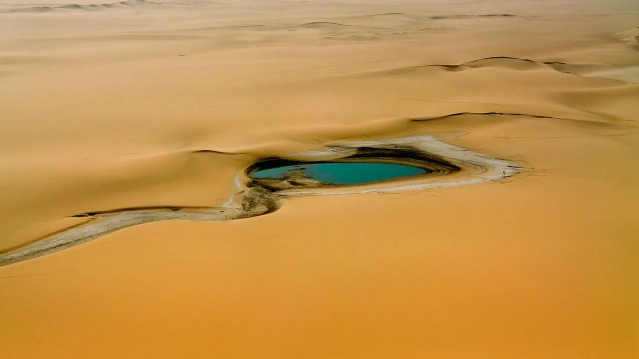
- Oasis: groundwater-fed pockets that support palm groves, settlements and agriculture.
The Green Sahara — ancient lakes, people and an evidence timeline
The African Humid Period (often called the Green Sahara) is central to understanding past variability. Paleoclimatic and archaeological evidence shows that much of today’s Sahara was once a mosaic of grasslands, lakes and rivers supporting human communities.
Concise timeline for quick reference
- ~15,000–14,500 years ago: wetter conditions begin following the Last Glacial Maximum and end-glacial warming.
- ~11,500–10,800 years ago: continued wet phases with intermittent shifts.
- ~6,000–5,000 years ago: progressive aridification culminates in the drying of many paleolakes and retreat of savannah zones.
Evidence types: lakebed sediments, pollen records, diatom assemblages, isotopic analyses, rock art depicting lakes and animals, dated archaeological sites and human remains. These converge to show human occupation and pastoralism across a landscape that changed dramatically over millennia.
Why the Sahara matters
- Human history & archaeology: Rock art panels, ancient settlements, and caravan routes record human adaptation and movement east, west, and north, as well as south.
- Climate science: Saharan dust contributes significantly to nutrient cycles (e.g. light nutrient carrier of iron and phosphorus to the Atlantic and Amazon, fertilisation) and is subject to weather interactions. A large source of dust is the Bodele Depression.
- Biodiversity & conservation: The desert is home to specially adapted species (e.g., fennec fox, addax, dorcas gazelle), some of which are critically endangered.
- Economics: Oasis towns and dune tourism contribute to the economic development of the local areas, whereas fossil and cultural heritage bring researchers and tourists.
- Current issues: water pumping of groundwater, overgrazing of marginal lands, and climate change.
How to visit the Sahara — best places, times, and safety tips
Many parts of the Sahara are highly accessible to tourists and have infrastructure (lodges, camps, organised tours). Other areas are remote and require specialist planning. Use reputable local operators and check current travel advisories for the specific country and region.
Top accessible visitor bases
- Morocco — Merzouga (Erg Chebbi): major tourist hub with many operators, camel treks and organised desert camps.
- Tunisia — Douz & Chott el Jerid: easy desert access with culture and salt-pan landscapes.
- Egypt — Siwa Oasis & Western Desert: culturally distinct oases and remote antiquities.
- Mauritania — Nouakchott & Chinguetti: historic caravan towns and Islamic manuscript heritage.
- Algeria — Hoggar & Tassili n’Ajjer: exceptional rock art and mountain deserts (access may be restricted; check permits).
- Mali, Niger, Chad: spectacular but remote — plan with experienced operators and verify the security situation.
Best times to visit:
- Shoulders: March–May and September–November for milder days and cooler nights.
- Avoid: the high summer months (June–August) in low basins due to life-threatening heat.
- Winter caution: nights can be cold in plateaus — pack warm layers.
Essential safety and planning checklist:
- Permits & paperwork: Some countries/regions require travel permits or local police notifications.
- Vehicle & driving: a reliable 4×4, spares, recovery gear, and sand-driving experience are essential for self-drive trips. Lower tyre pressure in sand and practice controlled momentum.
- Water & heat: carry 4–6 litres per person per day during active travel and more for extreme heat. Know the signs of heatstroke and dehydration.
- Communications: satellite phone or Personal Locator Beacon (PLB) recommended in very remote sectors.
- Local culture: respect religious and local customs; dress modestly in and near settlements; negotiate with local providers and confirm written terms when possible.
- Security: check up-to-date travel advisories from your government — political situations vary and can change rapidly.
Practical travel tips — condensed checklist
- Confirm permits & border crossing rules.
- Use reputable local operators for crossing extended stretches.
- Carry recovery equipment (shackle, tow strap, shovel, traction boards).
- Bring spare fuel, engine oil, tyre repair kit and at least one spare wheel.
- Pack sun protection: hat, scarf/keffiyeh, sunglasses, high-SPF sunscreen.
- Thermal layers for nighttime temperatures in higher elevations.
- First-aid kit and personal medications.
- Download offline maps and carry printed section maps plus the GeoJSON overlay if you use mapping apps.
Sample 3-day itinerary — Merzouga / Erg Chebbi
Day 1 — Arrival & acclimatisation
Arrive in Erfoud or Rissani from Marrakech. A short scenic drive introduces you to the changing topography. Late afternoon transfer to a desert camp. Reach the camp by camel or 4×4 at sunset. Night in a Berber-style tent under a brilliant star canopy.
Day 2 — Dune immersion & local culture
Pre-dawn climb of Erg Chebbi for sunrise (best light). Optional short camel trek or 4×4 sand-drive. Afternoon visits to ksar (fortified villages) like Rissani and local fossil workshops in Erfoud. Evening: cultural program — Berber music (gnawa/ahwach-style depending on region) and dinner at the camp.
Day 3 — Palm groves & departure
Morning visit to nearby palm groves, craft artisans, and local markets. Transfer back to Marrakech or onward to Fes; depart from Errachidia or other nearby airports. End of short desert segment.
Downloadable asset idea: merzouga_3day_sample_itinerary.pdf — include packing checklist, recommended operator list, vehicle checklist and contact templates.

Conservation, water issues & climate change signals
Key pressures:
- Groundwater depletion near oases from irrigated agriculture and tourist water use.
- Overgrazing at desert edges is causing localised land degradation and soil erosion.
- Flash flooding events — rare but intense rains can damage infrastructure and archaeological sites.
- Climate change may amplify extremes (stronger heat events, altered rainfall seasonality).
What scientists monitor:
- Satellite monitoring of the vegetation cover and paleolake areas.
- Isotopic and sediment cores to reconstruct humidity cycles in the past.
- Dust-source activity (e.g., Bodele Depression) and its causes and effects on marine productivity.
How travellers can help:
- Favour conservation programs of communities.
- Be low-impact (pack all wastes, save on water, and leave no harm to archeological sites or rock art occupations).
- Support operators that give back to the local communities and culture.
FAQs
Approximately 9.0-9.3 million km2 (the biggest hot desert). The number of estimates depends on the definition and method of mapping.
The Algerian country has the largest national proportion of Saharan regions.
No. The topography of the Sahara consists of a large part of plateaus (hamada) and gravel plains (regs). The most notable but not the majority are sand seas (ergs).
The African Humid Period (c. 14,600-14,500 to around 6,000-5,000) was the period during which there was wetness in the area with lakes and grasslands.
Yes – numerous places are friendly to the visitors (e.g., Merzouga, Douz). The operators should always have a good reputation, and it is also worth checking travel advisories about particular regions.
Conclusion
The Sahara Desert is not a simple sand-heap; it is a big and diverse habitat that covers a big portion of North Africa and has a massive geographical, historical and Environmental influence. It is massive and rough, and its history can be traced back to ancient times; its present and future remain a mystery to be unravelled. Sahara still manages to affect the region and impress the world. The knowledge of the place where the Sahara is located and what its nature is gives a better understanding of the natural and cultural heritage in Africa.


