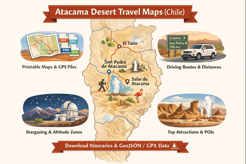
Introduction
This map-first guide bundles Everything a traveler or publisher needs to navigate and document the Atacama: conservative route data, printable A3/A4 maps, GPX/KML/GeoJSON downloads, stargazing overlays, and safety/conservation layers. Designed as a decision-support hub, it puts precise POI metadata (coordinates, elevation, permits, services) and downloadable assets front and center so users can plan safe, low-impact trips or publishers can produce linkable, reusable map slices.
Overview — what makes the Atacama special?
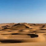
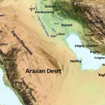
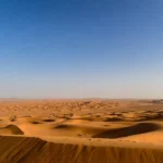
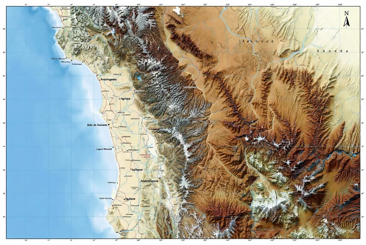
The Atacama is one of the most hyper-arid places on Earth; dryness, altitude, and stable atmospheric layers create landscapes that resemble lunar terrains and skies optimized for optical and radio astronomy. It is a long, narrow strip along northern Chile, pinned between the Andes to the east and the cold Humboldt Current along the Pacific to the west. The practical implication for maps: include stargazing/dark-sky layers, altitude markers, conservation zones, and clear definitions of the area you’re covering (which definition — coastal, interior basin, or full altiplano — matters to users).
Maps become instruments of decision-making: where to avoid off-road short-cuts near flamingo lagoons, where observatory buffer zones restrict access, where to plot fuel and water logistics, and which high passes require 4×4 vehicles. The best map-centric pages treat these as primary facets, not afterthoughts.
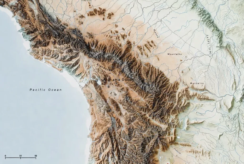
Location & Geography
Extent and boundaries
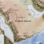
Model the Atacama as an indexed polygon set. A common definition covers ~1,600 km of coast and roughly 105,000 km². For your map pack, explicitly state the polygon(s) used and provide GeoJSON/KML that matches those boundaries so users and researchers can reconcile datasets.
Major towns & access points
- Calama (El Loa): primary regional airport, major fueling and supply center.
- San Pedro de Atacama: the tourism hub for lodging, guide hire, and KML/GPX handoffs.
- Smaller nodes: scattered mining towns and hamlets; map fuel points, clinics, and phone-signal corridors.
Map layers should list fuel-station operating times and phone-signal strength where possible. Flag any route sections with no services for tens or hundreds of kilometers.
Climate & Weather Patterns
Hyper-arid but variable
The Atacama is predominantly a cold desert with diurnal extremes: warm days, cold nights, and rare precipitation. However, outliers occur — cloudbursts, rare snowfall, and flash-flood events can alter access quickly. Add a flood-prone overlay, seasonal probability toggles, and a simple live-updates region on the download page so users can see recent closures or anomalies.
Best time to visit
- April–November: generally stable and dry nights — optimal for astrophotography and stargazing.
- December–February: warmer days but slightly higher convective activity in the altiplano.
For high-altitude visits, remind users that nights and early mornings can be dangerously cold. Provide a season toggle in the map UI (dry vs. wet probability) so travelers can plan accordingly.
Landscape Features — what to map
Conceptually, think of your map as a stack of layers in order of query importance. Below is a recommended priority ordering and rationale.
Map layers to include
- Base roads: distinguish paved vs unpaved and include road-surface type tags.
- Fuel stations: with operating hours and fuel types (if available).
- Accommodation & visitor centers: hotels, refugios, and permit offices.
- POIs: Valle de la Luna, El Tatio, Salar de Atacama, altiplanic lagoons.
- Elevation contours: include high-altitude flags (>3,500 m).
- Stargazing/dark-sky zones & observatory exclusion buffers.
- Protected areas & wetlands: flamingo habitats and sensitive salt pans.
- Emergency clinics and hospitals: full contact details.
- Walking trails & parking coordinates: trailheads and GPS parking pins.
- Offline tile packs & GPX tracks: downloadable assets.
Each layer should be filterable and exportable. Provide machine-readable metadata: source, last_updated, license, and attribution.
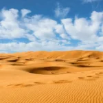
Salt flats and salar basins
Salar de Atacama contains important wetlands and flamingo feeding areas. Map these as protected polygons with “no-go” or “stay on track” annotations. Provide observation points and visitor guidelines.
Valleys & dune fields
Valle de la Luna is ≈13 km west of San Pedro — mark parking coordinates, key viewpoints, and trails like the Amphitheater and Big Dune. Include sunset vantage points and conservative arrival windows.
Geyser fields & geothermal features
El Tatio (≈4,320 m) is a high-altitude geothermal field that is best seen at pre-dawn. Include recommended departure times (~04:00–05:00 local), parking coordinates, entrance details, and altitude warnings.
Volcanoes & high plateaus
Chajnantor Plateau (ALMA) is at a height of 5,000 m. Include Observatory buffer zones, restricted access notes, and approximate coordinates of scientific facilities. Respect access rules — do not suggest routes that traverse restricted observatory land.
Flora & Fauna — fragile ecosystems
Annotate altiplanic lagoons, flamingo habitats, and fragile lichen crusts. Add a conservation toggle that overlays “Leave No Trace” instructions on printable maps and includes contact info for local conservation agencies. Use discrete icons and ensure that wildlife-sensitive zones are visually de-emphasized for vehicle traffic.
Human History & Culture
The desert contains archaeological sites, petroglyphs, and community landmarks (e.g., Gustavo Le Paige museum). Include cultural-sensitivity notes: no artifact removal, respect community land, and no climbing on fragile sites. Provide POI metadata that lists site custodians and, where possible, links to visitor permissions and permitted tour operators.
Survival Tips & Challenges — map-first safety
Altitude sickness & acclimatization
Many sites are above 3,000 m. Model elevation at the POI level and flag sites above 3,500 m with a high-altitude alert. Recommends a 24–48 hour acclimatization window in San Pedro before heading higher. Provide a simple algorithmic checklist for symptoms and emergency steps.
Fuel, water & emergency services
- Water: recommended minimum for remote day trips ≥ 4 L per person (more for multi-day loops).
- Fuel: map stations and hours; annotate long sections without fuel.
- Clinics: mark hospitals with full addresses and phone numbers.
Include a downloadable safety-card PDF that lists emergency numbers, nearest clinics by road distance, and first-aid pointers.
Road conditions & vehicle recommendations
- Paved main roads: generally suitable for 2WD cars.
- Scenic loops/altiplano tracks: 4×4 recommended.
- Unpaved timing: assume 30–40 km/h for time estimates.
- Hazards: washboard sections, single-lane passes, dry riverbeds.
Add a “vehicle-fit” toggle that explains which roads require raised suspension or lower gearing. Suggest that users consult local rental companies for vehicle suitability.
Tourism — attractions, activities & map-based itineraries
Every itinerary should be available as: A4/A3 printable PDF, GPX track, and POI coordinates with elevation. Provide both a summarized route card and a detailed per-segment table (km, elevation, permit needs, worst-case time).
Suggested itineraries
Use intent buckets (short, medium, long) and produce an associated map/asset bundle for each.
| Itinerary | Duration | Main highlights | Vehicle | Estimated driving (km/day) |
| San Pedro half-day | 0.5–1 day | Town + Valle de la Luna (sunset) | 2WD | 30–60 |
| Classic 3-day loop | 3 days | Valle de la Luna, Lagunas Altiplánicas, Piedras Rojas, El Tatio | 4×4 recommended | 80–200 |
| Altiplano 7-day circuit | 7 days | Full altiplano, salt flats, remote lagoons | 4×4 | 200–800 |
| Mountain bike loop | 2–4 days | San Pedro area tracks, dunes | Bike + support vehicle | 40–120 |
For each itinerary, provide:
- A downloadable map PDF (A3 road map + A4 day-sheets).
- GPX with nested tracks (driving track + walking subtracks).
- POI GeoJSON for quick import into mobile apps.
- Conservative time estimates and fuel/water minimums.
1-day sample
- Morning: San Pedro walk — Gustavo Le Paige museum, artisan market, public parking.
- Afternoon: Drive Valle de la Luna loop — brief hikes at Amphitheater & Big Dune; provide parking coordinates and walking trail pins.
- Sunset: Sunset viewpoint — allocate 1–2 hours; include coordinates and best parking.
3-day classic
- Day 1: San Pedro → Valle de la Luna → Salar viewpoint. Map driving distance and parking GPS.
- Day 2: Lagunas Altiplánicas (Miscanti & Miñiques) + Piedras Rojas — mark 4×4 sections and altitude warnings.
- Day 3: Early start to El Tatio (depart ~04:00–05:00) with return via hot springs; flag altitude and clinic locations.
Each downloadable itinerary file should show driving km, GPS coordinates, elevation, estimated conservative driving time, and suggested fuel/water minimums.
Stargazing & astronomy overlays
Why Atacama is special for astronomy
Dry air, altitude, and stable atmospheric layers make the Atacama ideal for observatories. ALMA sits on the Chajnantor plateau (~5,000 m) and world-class dark-sky sites cluster around San Pedro and the high plateaus.
Map layers to include for astronomy
- Dark-sky spots with recommended horizon clearances.
- Observatory buffer zones and restricted zones.
- Light pollution index layer for night-photography planning.
- Moon-phase + twilight toggle for timing night-sky sessions.
In the interactive map, add a night-mode toggle where moon phase overlays and twilight times render alongside POIs. Allow astrophotography users to export a “shooting plan” PDF that includes best nights (moon phase), elevation horizon maps, and recommended coordinates.
Map data, licensing & technical notes
Data sources & attribution
- Use OpenStreetMap (OSM) for base tiles and road geometry.
- Supplement with satellite imagery (include provider attribution).
- Use the WGS84 coordinate reference system and state it in metadata.
- Apply clear licensing: consider CC BY-SA for map extracts and overlays; specify required attribution and link-back policy.
File optimizations
- Serve gzipped KML/GeoJSON.
- Slice large GeoJSON into tiles or regions for faster load.
- Use vector tiles and lazy-load heavy layers (offline tile packs, high-res satellite).
- Offer small preview PNGs for each downloadable asset to reduce friction.
Pros & Cons
Pros
- A single authoritative hub draws backlinks from astronomy, overlanding, and conservation communities.
- High utility: printable PDFs + GPS files increase user satisfaction and engagement.
- Map-based guidance improves safety and protects sensitive habitats.
Cons
- Maintaining accuracy is ongoing work; roads and service hours change.
- Large files and tiles require CDN hosting and efficient caching strategies.
- Legal obligations: restricted areas, observatory buffers, and permit regimes require careful notice.
Environmental issues & conservation
Include conservation overlays (protected wetlands, flamingo habitats, archaeological zones). Add “Leave No Trace” guidance in every PDF. Note industrial pressures (mining, light pollution) and include a community CTA (e.g., “support science-friendly zoning”) for advocacy and link-building. Add a small live-news feed or last_24h_update block on the download page for closures due to weather or permits.
Interesting facts & outreach hooks
- Some regions report decades without measurable rainfall — a striking map annotation.
- ALMA’s high-altitude location is a magnet for astronomy backlinks.
- Valle de la Luna has a documented history of Mars-rover tests and analog missions — great for outreach to space and science editors.
Use these hooks as “link bait” nodes with high-quality downloads and shareable map slices (e.g., “ALMA plateau PDF + coordinates”).
Practical map-based routing examples
Example: Calama → San Pedro
- Distance: ≈100–106 km.
- Typical driving time: ≈1.5–2 hours, depending on stops and road conditions.
Include Calama airport terminal coordinates, recommended fueling points, and rest-stop pins.
Example: San Pedro → El Tatio
- Distance: ≈90 km, altitude rise to ≈4,300 m.
- Guidance: depart before sunrise (~04:00–05:00), include acclimatization warnings, and mark nearest clinics.
One required table
| Format | Best for | Pros | Cons |
| PDF (A3/A4) | Printable road map | Universal, easy offline | Static, no routing |
| KML | Google Earth, desktop GIS | Rich styling, placemarks | Large with many points |
| GeoJSON | Web mapping & QGIS | Lightweight, web-native | Some apps lack support |
| GPX | GPS devices & track playback | Simple route-following | Styling limited |
| Offline tiles | Mobile apps (OsmAnd, Maps.me) | Fast, no internet | Large storage needed |
Download checklist — what every map pack should include
- A3 printable map (PDF) with a clear legend and scale.
- A4 itinerary PDFs for half-day, 3-day, and 7-day trips.
- KML for Google Earth with separate layers for POIs & trails.
- GeoJSON for web use and QGIS ingestion.
- GPX tracks for major itineraries.
- Offline tile pack guide and recommended tile ranges.
- README with import instructions, checksums, and “last updated” metadata.
FAQs
Short answer: You can drive many main paved routes in a 2WD, but many scenic loops and altiplano roads require a 4×4. Always check the map’s road surface layer and local tour advice.
Roughly 100–106 km, usually around 1.5–2 hours depending on stops and traffic. Plan for a fuel stop in Calama before leaving.
Near San Pedro and on the high plateaus (Chajnantor area) are among the best. Use the stargazing overlay to pick dark-sky locations and avoid observatory exclusion zones.
Yes — some altiplano lagoons and protected areas have entry fees or visitor limits. Map your permit offices and visitor centres in San Pedro to avoid surprises.
Open Google Earth → File → Open → select .kml file. For large files, use Google Earth Pro and load layers individually to avoid slowdowns.
Conclusion
A high-quality Atacama map hub is both a safety tool and a content magnet: accurate downloads (PDF, GPX, KML, GeoJSON), clear conservation warnings, and conservative routing guidance improve user safety and attract backlinks from astronomy, conservation, and overlanding communities. Maintain clear licensing, Updated layer metadata, and a simple download/readme workflow to keep the hub reliable — and offer individual map slices (ALMA plateau, flamingo lagoons, 3-day loop) as outreach hooks for partner sites.