Introduction
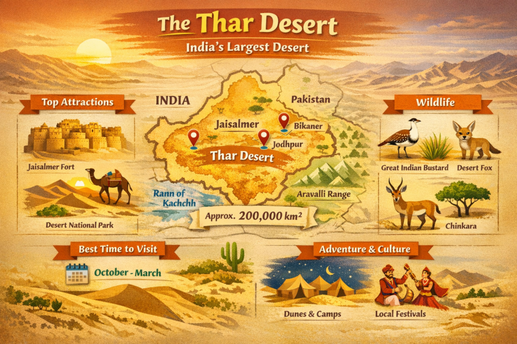
The Thar Desert (or the Great Indian Desert) is the biggest in India, covering a huge area of dunes, mountainous landscape, temporary lakes, and strong communities. This short brochure gives the tourists and the operators of the touring websites a concise and handy set of tips: where to go (Jaisalmer, Bikaner, Jodhpur), what/when to go (dunes, forts, Desert National Park), why and why present conservation details are necessary (Great Indian Bustard).
Quick facts
- Sometimes called: Thar Desert, Great Indian Desert.
- Area: It is the territory divided between India and Pakistan, estimated at around 200,000 km² (77,000 sq mi).
- Large state (most significant percentage): Rajasthan.
- Best tourist gateways: Jaisalmer, Bikaner, Jodhpur, Barmer.
- Major conservation and Dune landscape area: Desert National Park (in and around Jaisalmer) – a major conservation area.
- Most suitable months: October-March (cooler days, cold nights and numerous festivals)
What and where is the Thar Desert?
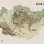
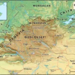
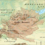
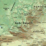
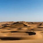
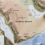
The Thar Desert is situated in northwestern India and southeastern Pakistan. Most of the desert in India is in the state of Rajasthan and borders the Aravalli Range to the east and other arid areas like the Rann of Kachchh to the south. The physical makeup of the Thar is diverse, including mobile and fixed dunes in line with the blowing wind, wide sandy plains, rocky outcrops and mesas, seasonal salt lakes and pans, and small areas which turn green during and after the monsoon.
Human settlement is a constituent of the Thar. The landscape is patterned with towns, villages, markets and agricultural belts. They herd camels, goats and sheep; they cultivate in canal-fertilised regions; they also practise crafts and textiles; and they entertain travellers. Geographically and ecologically speaking, the Thar should be considered as a complex of interacting components: climate (hot, arid, large temperature swings), soils (sandy and saline in some areas), vegetation (xeric shrubs and halophytes), fauna, adjusted to lack of water, and human alterations through irrigation and infrastructure.
How big is the Thar — mapping the desert
Area estimates vary because different sources include or exclude nearby semi-arid plains and salt marshes. A common figure is around 200,000 km². For any website or downloadable map set, provide two boundaries:
- Conservative boundary — the core desert biome (dunes, sandy plains and true arid patches).
- Broader boundary — the desert plus adjoining semi-arid zones, saline flats and transitional grasslands.
Recommended downloadable assets to host on your page (filenames that help SEO and linkbacks):
- thar-map-pack.kml (Google Earth KML)
- thar-printable-map.svg (high-resolution vector for print)
- thar-infographic.pdf (hero infographic, printable)
Hosting these files helps authority and invites backlinks. For each file, include a short description, license terms (if you allow re-use), and a lightweight attribution statement. Offer both conservative and broader KML layers so researchers and travellers can choose the level of inclusion.
Landscape and key features
The Thar is not one single surface — it is an interplay of landforms and habitats. Below are the main landscape features to describe on your page.
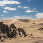
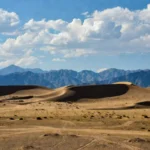
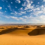
Dunes and sand bodies
Sand is blown by the wind into various dune forms: the long and sponge-like chains, crescentic dunes and more angular and ridged dunes. The movement of dunes (mobile dunes) or stabilisation of dunes (fixed dunes) depends on vegetation, human constructions and the amount of sand. The classic desert landscape is composed of dunes, which provide great sunset and sunrise photography.
Rocky ridges & mesas
Some zones contain harder rock — low hills, ridges and mesas — that contrast with soft sand. These areas trap moisture, support distinct plants, and create varied habitats for animals. Rocky outcrops can shelter villages and ancient fortifications.
Salt pans & seasonal lakes
Salt pans and lagoons like Sambhar Lake and other seasonal basins fill up with water after a heavy monsoon rain and dry up. These areas are made into temporary hotspots for birds and are significant to migratory species.
Human-shaped features
Large canal projects (e.g., the Indira Gandhi Canal / IGNP), smaller irrigation works, roads and settlements have “greened” some parts of the Thar. This has positive effects for agriculture and local livelihoods, but it also alters grassland habitats that species like the Great Indian Bustard depend on.
Climate & month-by-month visiting guide
The Thar Desert has wide daily temperature swings, extremely hot summers and mild to cold winters. Most rainfall arrives with the southwest monsoon (summer).
Month guide for travellers and photographers
- January–February: Cool days, cold nights — excellent for camping and photography.
- March–April: Warming; when winter rains have occurred, short desert blooms may appear.
- May–June: Hottest time — avoid long daytime exposure and strenuous treks.
- July–September: Monsoon season — variable rains, temporary greening, sometimes muddy track conditions.
- October–December: Peak tourism months — pleasant days, cold nights and many local festivals.
Practical tip: Always check local weather forecasts and road conditions before heading into remote dunes. Use local tour operators who know seasonal track conditions.
Flora — plants that survive here
Vegetation in the Thar is adapted to low water, saline soils and heat. Main plant groups include:
- Xerophytes: Trees like Khejri (Prosopis cineraria), thorny shrubs and drought-resistant grasses. These plants reduce soil erosion and can stabilise dunes.
- Halophytes: Salt-tolerant species near pans and saline flats.
- Cultivated belts: Where canal irrigation reaches, farmers grow wheat, mustard, cumin and other crops.
Vegetation not only shapes the desert visually but also supports grazing, biodiversity and microclimates. Host pages about native plant uses (fodder, medicinal) to add cultural depth.
Fauna — wildlife highlights
The Thar supports a suite of animals adapted to its conditions. Notable species:
- Great Indian Bustard (GIB): A very rare, critically Endangered grassland bird. Conservation programmes include captive rearing, egg-replacement pilots and habitat protection. Sightings are rare, and any wildlife tour must follow rules and guided access.
- Mammals: Chinkara (Indian gazelle), desert foxes, striped hyena, and small mammals adapted to aridity.
- Reptiles & invertebrates: Monitor lizards, skinks, agamid lizards, scorpions and a host of desert arthropods.
- Birds: Raptors, sandgrouse, larks and migratory waterbirds that visit seasonal wetlands.
Protected areas: Desert National Park is central for dune and grassland conservation and is a recommended stop for nature watchers.
Note on conservation protocols: Many conservation efforts (egg replacement, artificial incubation, captive breeding) are sensitive. Do not share exact nest or release locations on public pages; instead, link to official updates and conservation groups.
Human history, culture & crafts
Human life has flourished in and shaped the Thar for centuries. Key cultural points:
- Pastoral traditions: Nomads and semi-nomadic pastoralists have long moved animals with seasonal changes.
- Trade routes: Historic caravan routes lent the region its mix of cultural influences.
- Crafts: Block printing, leatherwork, stone carving and intricate embroidery are classic skills that create local livelihoods and visitor experiences.
- Festivals: Events like the Desert Festival (Jaisalmer) showcase music, folk dance and camel culture.
- Architecture: Forts and havelis (ornate mansions) in Jaisalmer and Bikaner reflect desert architecture that uses local sandstone and features narrow lanes and courtyards to manage heat.
Adding short human stories (interviews, a craftsperson profile) on a website increases dwell time and local relevance.
Tourism — top attractions & activities
Top attractions
- Jaisalmer Fort: The “Golden City” on a rocky outcrop, full of narrow streets and sandstone havelis.
- Sam & Khuri Sand Dunes: Classic sunset and sunrise camel rides, and overnight desert camps.
- Desert National Park: Dunes, wildlife and nature drives.
- Bikaner: Forts, camel research farms and bustling local markets.
Activities
- Camel safaris: A slow, immersive way to experience dunes and local culture.
- Jeep safaris/dune drives: Allow access to more remote dunescapes and photographic vantage points.
- Birding & wildlife drives: Best near seasonal lakes and protected grasslands.
- Cultural stays & homestays: Learn Rajasthani music, cuisine and crafts from local hosts.
Tip: Use certified operators and responsible tourism practises — especially in protected areas and when interacting with wildlife.
Sample itineraries
Itinerary
| Itinerary | Duration | Highlights | Who it’s for |
| Quick Jaisalmer Sam Loop | 2 days | Jaisalmer Fort, Sam Dunes sunset, camel ride | Short-trip travellers |
| Cultural + Wildlife Loop | 4 days | Jaisalmer → Sam → Desert National Park → Bikaner | Culture & wildlife mix |
| Off-grid Expedition | 7+ days | Villages, quiet dunes, conservation visits | Photographers, researchers |
Detailed 3-day example
- Day 1: Arrive in Jaisalmer. City tour, visit Jaisalmer Fort, stroll in the bazaars, and visit Gadisar Lake at dusk.
- Day 2: Drive to Sam Sand Dunes for a sunrise camel ride and afternoon dune activities. Overnight in a cultural desert camp with music and storytelling.
- Day 3: Morning safari in Desert National Park (if available), birdwatching/short wildlife drive, then return to Jaisalmer or proceed to Bikaner.
Practical travel guide — transport, permits, stays, packing
How to reach
- By air: Larger airports near the Thar include Jodhpur (major hub) and Jaisalmer (smaller, limited).
- By train: Jaisalmer and Bikaner have rail links to key cities. Overnight trains are common.
- By road: Buses and private cars connect the main towns. Road conditions vary by season.
Permits & safety
- Most tourist routes do not need special permits.
- Border areas and some sensitive zones require permissions; always check with district authorities or tourism offices.
- Wildlife areas may require park permits and guided entry — follow official rules.
Where to stay
Options include heritage havelis, city hotels, tented desert camps (budget to luxury) and community homestays. Book desert camps through reputable operators that follow sustainable and safety guidelines.
Packing checklist
- Layered clothes (for hot days and cold nights).
- Wide-brim hat, sunglasses, sunscreen.
- Sturdy shoes, plenty of water, first aid kit.
- Flashlight and spare batteries, camera protection.
- Copies of ID and travel documents.
Safety note: Avoid walking alone in remote dunes after dark; travel with guides and local operators.
Interesting facts & human impact
- The Thar is one of the world’s most densely populated deserts — people have lived here for centuries, and modern irrigation has enabled larger settlements.
- Large irrigation projects such as the Indira Gandhi Nahar Pariyojana (IGNP) have changed the landscape, bringing crops and new livelihoods but also altering natural grasslands.
- These changes have mixed effects on wildlife and ecology; some species adapt and expand while others decline.
Environmental issues & conservation
Greening and water change
Satellite data and regional studies indicate that parts of the Thar are becoming greener in some periods due to rainfall variability and irrigated agriculture. While greening can enhance livelihoods, it can also replace native grasslands and reduce nesting habitats for species like the Great Indian Bustard.
The Great Indian Bustard — why it matters
The GIB is a large grassland bird and a major conservation symbol. Populations have suffered from habitat loss, collisions with powerlines, and increased disturbance. Conservation measures include protected habitat management, powerline mitigation, captive-rearing and egg-replacement programmes. These interventions are sensitive; when writing about them, link to official updates and avoid revealing precise nest or release sites.
Community conservation
Local villagers, pastoralists and conservation groups often collaborate to protect nesting areas and manage grazing. Community involvement is critical for long-term success.
Pros & Cons
Pros
- Iconic landscapes and rich cultural experiences.
- Decent tourism infrastructure in major towns.
- Unique wildlife and conservation learning opportunities.
Cons
- Extremely hot summers and some seasonal road closures.
- Greening/agriculture can reduce the chances of seeing some species.
- Border areas may require permission and occasional security checks.
Quick comparison — Jaisalmer vs Bikaner
| Feature | Jaisalmer | Bikaner |
| Fort & havelis | Iconic sandstone old city | Magnificent forts (Junagarh) |
| Dunes | Sam & Khuri are nearby | Smaller dune fields |
| Wildlife | Gateway to Desert National Park | Camel research & culture |
| Best for | Sunset dunes, photography | Cultural heritage, camel culture |
FAQs
The Thar Desert, also called the Great Indian Desert, is the largest desert in India.
Roughly 200,000 km² (≈77,000 sq mi) across India and Pakistan, depending on the exact boundaries used.
October–March — cooler days and cold nights, good for safaris, camps and festivals.
The Great Indian Bustard is critically endangered and hard to find. Sightings are rare; the best chances are with guided conservation visits in protected grasslands. Please don’t share exact nest or release locations online.
Yes — include a KML for Google Earth, an SVG for print, and a PDF infographic for visitor pages. Suggested filenames: thar-map-pack.kml, thar-printable-map.svg, thar-infographic.pdf.
Simple conservation checklist for visitors
- Stay on marked routes in protected areas.
- Hire licensed guides for wildlife drives.
- Do not disturb nests or wildlife.
- Carry water and keep the desert clean.
- Support community-run homestays and conservation fees.
Conclusion
The Thar Desert has memorable scenery, rich culture and significant conservation tales. People travelling should plan during the colder season and hire licensed guides; publishers should consider adding more accurate maps. In the first place, Responsibly protect the desert- respect habitats, invest in the local community, and maintain GIB and other wildlife protection as a priority.