Introduction
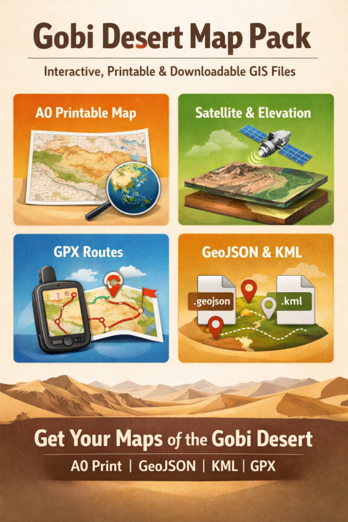
This pillar collects everything a map-maker, field team, or Publisher needs to build a practical, conservation-aware map pack for the Gobi Desert — A0 print-ready posters, GeoJSON/KML/GPX exports, and a compact SVG icon set. It blends landscape-by-landscape mapping guidance, sensitive-data rules (for sites such as Khongoryn Els, Flaming Cliffs (Bayanzag), and Great Gobi), plus the technical recipe and UX flow you need to publish reliable downloads across Mongolia and China.
Quick facts
- Area: ~1,300,000 km² (≈500,000 sq mi).
- Long axis: ≈1,600 km (east–west).
- Main countries: Mongolia and China.
- Dominant biomes: cold desert, semi-desert, desert-steppe.
- Notable places: Khongoryn Els, Flaming Cliffs (Bayanzag), and Great Gobi.
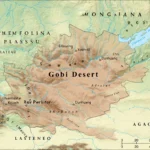
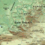
Location & geography — Mongolia & China
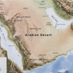
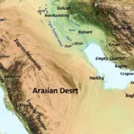
The Gobi forms a large crescent across interior Asia. It is bounded by mountain systems to the north and west, including the Altai ranges, and drops toward lower basins and plateaus to the south and east. Much of the Gobi is not “sand” in the stereotypical way — expect gravel plains (reg), rocky ground, salt pans, interdunal corridors, and only localised sand seas such as the Khongoryn Els. For mapping, the Gobi’s sheer scale means you must offer tiled and layered downloads: regional overview files plus local high-detail route maps.
Practical mapping implication: don’t try to show the entire Gobi at full resolution in a single vector file. Instead, distribute a small number of large-scale overview maps (suitable for A0 print) plus more granular GeoJSON/KML/GPX route files that focus on travel corridors, known water points, protected-area boundaries, and high-value POIs.
Landscape matrix
Below are the primary landscape classes encountered across the Gobi, with concrete recommendations for which map layers to include and what operational notes to attach.
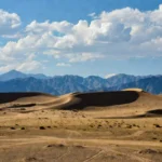
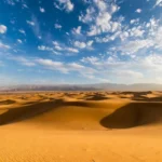
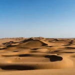
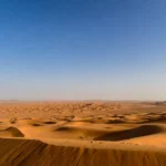
Sand seas & linear dunes — major dune fields like Khongoryn Els
- Map layers to include: dune polygons (with imagery-date attribute), dune crest lines, slope hillshade, and access tracks.
- Notes: dunes migrate. Indicate the date of the imagery used and a Confidence score. Recommend users verify dune crossings with local guides.
Rocky plateaus & badlands — e.g., the Flaming Cliffs (Bayanzag)
- Map layers: rock outcrop polygons, fossil-site buffers (generalized), protected-area classification.
- Notes: mark fossil protection rules and legal advisories.
Stony plains (reg) — broad gravel surfaces
- Map layers: OSM tracks as baseline, user-contributed GPX tracks, elevation contours, micro-topography where available.
- Notes: vehicle tracks may be faint; timestamped GPX is crucial.
Salt pans & ephemeral lakes
- Map layers: pan polygons, seasonal water flag, substrate notes (mud/alkaline).
- Notes: add advisories — pans can be dry one season and treacherous the next.
Riparian strips & oases
- Map layers: springs, wells, reedbeds, irrigated fields.
- Notes: often the only reliable water sources — prioritise these in downloadable waypoints and include last-verified date.
Quick mapping table
- Dunes → dune polygons, hillshade, access tracks — include imagery date.
- Badlands → rock polygons, fossil buffers, protection status — show permit links.
- Stony plains → OSM/GPX tracks, contour lines — include vehicle-recovery notes.
- Salt pans → pan polygons, seasonal water notes — advise against wet crossings.
- Riparian strips → springs, wells, vegetation polygons — mark reliability and verification year.
Climate & weather patterns — practical mapping notes
The Gobi is a cold desert. That classification drives both travel planning and how you publish map metadata.
Operational climate facts
- Winters are extremely cold (often below −30 °C in places), making roads impassable.
- Summers can reach ~40 °C during heat spells — heat stress and limited shade.
- Precipitation is low and highly seasonal; many areas average <200 mm/year.
- Wind is frequent and can reduce visibility and alter dune morphology.
Mapping takeaways
- Attach a “seasonality” or “when-to-use-this-map” note to each route GPX file. For example, a track safe in mid-June may be hazardous in October due to snow, temperature change, or freeze-thaw track damage.
- Use date-stamped GPX tracks and insist on a time attribute in waypoints. Provide a confidence or veracity attribute in the GPX/GeoJSON properties to let users know how fresh the data is.
- Provide a short “weather-readiness” checklist with each downloadable route: minimum fuel, water, communications, winter gear, or dust-protection as relevant.
Flora: What grows in the Gobi?
Plants are sparse but ecologically critical and should be represented thoughtfully on maps.
Key vegetation types to include as layers
- Saxaul (Haloxylon spp.) — helpful windbreaks and grazing indicators. Map as point clusters or small polygons.
- Bunchgrasses (Stipa spp.) — indicate pasture quality; include seasonal grazing notes.
- Riparian reeds and willow thickets — mark these as primary water indicators and sensitive habitats.
Cartographic guidance
- Provide a vegetation-sensitivity layer (e.g., high/medium/low) so that tour operators and visitors can plan to avoid fragile areas.
- Where possible, include a last_observed date and a short source attribute in the vegetation layer.
Fauna: species that matter for conservation and for visitors
Species presence both enriches the map content and constrains what you can publish. The main conservation-relevant species to consider in your dataset:
- Wild Bactrian camel (Camelus ferus) — rare and critical. Represent as range polygons, not discrete points.
- Gobi bear — extremely rare; treat presence data as sensitive.
- Snow leopard — upland areas; show general range with permit advisories.
- Asiatic wild ass, argali, gazelles, and priority birds — include range/observation heatmaps but avoid precise localities.
Sensitive-data best practice
- For critically endangered species, use generalized polygons (≥5 km blur) or abstracted occurrence zones rather than precise GPS points.
- Consider making sensitive species layers available only after a checkbox that enforces a data-use policy. For fossil localities and nesting sites, follow the same approach.
Human history & cultures
Cultural and historical context is important for respectful mapping and legal compliance.
- The Gobi contains important palaeontological sites such as the Flaming Cliffs (Bayanzag) — do not publish precise dig-site coordinates; include legal notices and permit contact info.
- Nomadic pastoralism is the predominant local livelihood; where available, indicate seasonal grazing zones and migratory corridors. Don’t publish exact herd locations.
- Protected areas such as the Great Gobi and national reserves have variable permit regimes — including authoritative boundaries and links to permit offices.
Cartographic etiquette
- Add a short “do no harm” statement in the README and manifest that explains the dataset’s approach to sensitive data and cultural sites.
- Cite national regulations about fossil collection and protected area entry.
Tourism: attractions, activities & travel tips
Top visitor highlights
- Khongoryn Els — dune climbs, camel treks, dramatic sunsets.
- Flaming Cliffs (Bayanzag) — fossils and dramatic sandstone; follow protected-area rules.
- Great Gobi — wildlife tours and survey opportunities.
Sample itineraries
- 1-day: arrive in Dalanzadgad → short transfer to Khongoryn Els for a dune climb and sunset.
- 7-day loop: Khongoryn Els → Yolyn Am → Flaming Cliffs (Bayanzag) → local nomad camp.
- 5–10 days: Great Gobi circuit (requires permits and experienced guides).
Safety & planning essentials
- Carry generous water and fuel margins.
- Use high-clearance 4×4 vehicles with recovery gear and satellite comms.
- Hire local guides and arrange permits for protected areas.
- Check satellite weather and road reports before departure.
Styling & cartography
Design decisions for print and web diverge; keep a consistent visual grammar to reduce cognitive load for users switching between formats.
A0 print design notes
- Usea 300 dpi raster for A0 exports. Flatten raster hillshade with vector overlay for crisp print.
- Keep typography legible at a distance — consider a 14–16 pt minimum for the smallest readable label on A0.
- Provide an inset locator map so users understand the map’s scope. Include a latitude/longitude grid and graticule as an optional layer in the PDF.
Web map design notes
- Provide a responsive viewer that allows users to toggle layers and download them individually.
- Keep icons compact and consistent with the A0 legend.
- Add an “About this dataset” panel with direct links to the manifest and README.
Quality control & validation
QA is essential if you want users to trust your downloads.
Field-checking
- Arrange field validation for a subset of routes (3–5 exemplar routes) with local partners. Record GPS traces and photos; add these as field_verification entries in the metadata.
Automated checks
- Run scripts to detect improbable GPX tracks (e.g., unrealistic speeds >120 km/h).
- Validate projections (EPSG:4326) and check for coordinate anomalies (nulls, swapped lat/lon).
Open data audit
- Keep a data_audit.csv listing each source, last checked date, and who verified it. Publish the audit summary on the download page.
Examples & sample GPX waypoints
GPX waypoint attributes
- name, desc, sym, time, extensions with source and confidence.
Make sure each GPX file’s header includes a short description and a link to the manifest. Encourage users to report corrections using a simple form that attaches to a report_id field in your manifest.
Conservation & sensitive-data best practice
When publishing maps that include conservation data, follow these concrete rules:
- Don’t publish precise GPS points for critically endangered species. Use blurred polygons (≥5 km) or presence/absence tiles.
- For fossil localities, mark general areas but do not share dig site coordinates. Include legal notices.
- Include a data_sensitivity field in the manifest and provide a short human-readable policy.
Short note on data currency
To retain user trust, run these maintenance tasks:
- Re-run imagery and tile updates every 6–12 months.
- Provide an audit log and accept user corrections via a “Report an issue” form.
- Re-validate GPX tracks after major weather events or new road construction.
Roadmap: follow-up articles to boost topical authority
Publish these complementary pieces within weeks of the map pack release:
- How to print A0 maps for fieldwork — print settings and paper types.
- Gobi dune types explained — a geology primer.
- How to import our GPX routes into common devices (Garmin, OsmAnd, Gaia GPS).
FAQs
A: About 1.3 million km² (≈500,000 sq mi). That’s the same stat used by major encyclopedias.
A: Yes. Some famous dune fields like Khongoryn Els have long linear ridges and large dunes. But much of the Gobi is rocky or stony.
A: Yes — the Flaming Cliffs (Bayanzag) are world-famous for dinosaur eggs and fossils. Removing fossils without permits is illegal.
A: Wild Bactrian camels, Gobi bears (very rare), Asiatic wild ass, snow leopards in uplands, gazelles, and many birds. Many species are conservation priorities.
Conclusion
Ship a lightweight, well-documented pack with clear sensitive-data rules, time-stamped metadata, and an audit trail so researchers, guides, and Conservation teams can trust and reuse your files. Follow the checklist and QA steps in the article, keep datasets current, and your map pack will be both more useful in the field and more discoverable to users searching for high-quality downloads.