Introduction
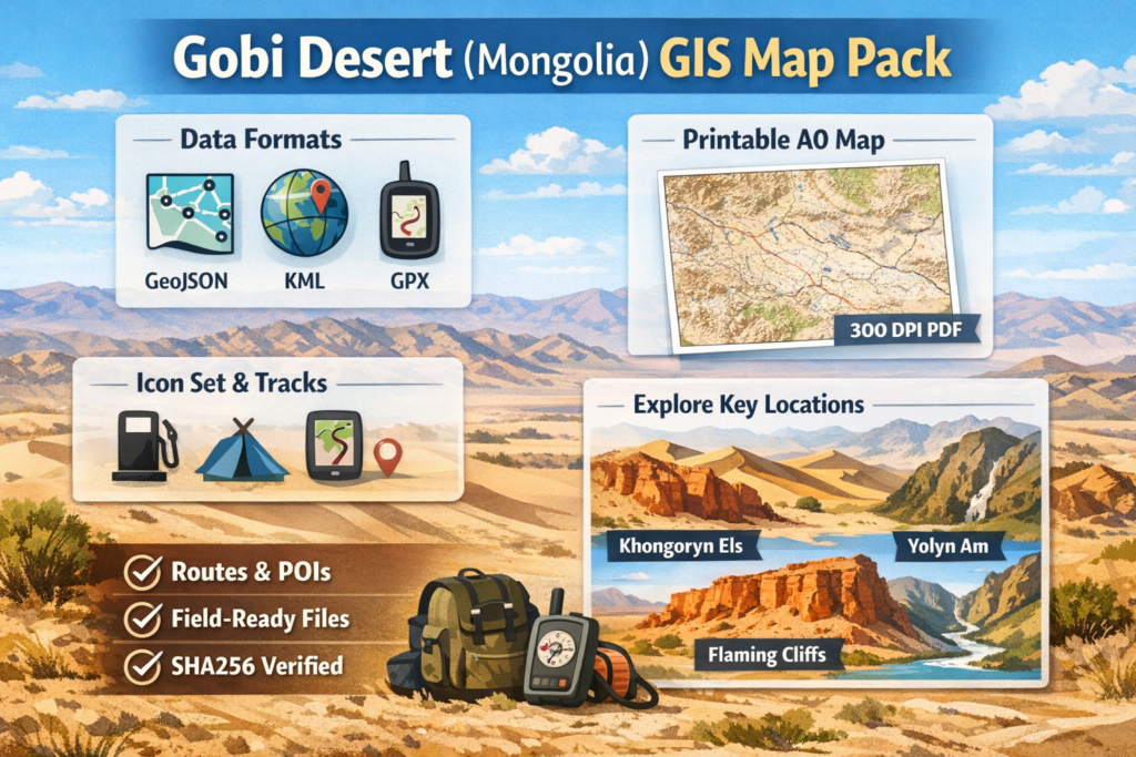
This concise Gobi Map Pack package publishes print-ready GIS and print assets for fast use: GeoJSON, KML, GPX tracks, an A0 300-DPI basemap, SVG icons and a README with SHA256 checksums — all formatted for both field use and machine ingestion for the Gobi Desert. It also includes tested itineraries for key sites like Khongoryn Els and Flaming Cliffs (Bayanzag), plus clear redaction and provenance rules so editors, cartographers and travellers can trust and reuse the data.
At a glance — quick facts & immediate downloads
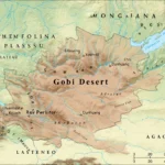
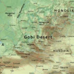
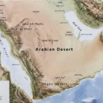
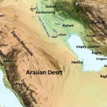
Area: roughly 1.2–1.3 million km² across southern Mongolia and northern China.
Climate type: cold desert / semi-arid steppe — extreme seasonal swings (winter lows well below −30°C in places; summer highs into the 30s–40s°C).
Best windows to visit (comfortable): mid-April → June and September → October.
High-value POIs: Khongoryn Els, Flaming Cliffs (Bayanzag), Yolyn Am, Baga Gazriin Chuluu.
Base town/logistics hub: Dalanzadgad — fuel, permits, basic services.
Immediate downloads
- GeoJSON (roads, POIs, protected areas) — for web & QGIS — gobi_roads.geojson, gobi_waterpoints.geojson, gobi_protected_areas.geojson.
- KML (Google Earth) — quick inspection.
- GPX (tracks & waypoints) — device-ready for Garmin / phones.
- A0 printable basemap (300 DPI PDF) — hillshade + contours, ready to print.
- SVG icon set (32 icons) — campsite, fuel, water, fossil site, museum, ger stay.
- README + SHA256 checksums — provenance & verification (each file listed with checksum and last_verified date).
What’s included — manifest
Main deliverables
- interactive_map/ — a Leaflet/Mapbox-ready package with vector layers and styling JSON.
- data/gis/
- gobi_roads.geojson — type field: {sealed, gravel, track}; last_verified; source.
- gobi_waterpoints.geojson — seasonality, gps_accuracy, notes.
- gobi_protected_areas.kml — boundaries + access notes.
- gobi_pois.geojson — poi_type, description, sensitivity_level.
- tracks/
- khongoryn-els-3day.gpx (1–3 day sampler)
- flaming-cliffs-nemegt-7day.gpx (4–7 day)
- south-gobi-14day.gpx (8–14 day expedition)
- print/a0/
- gobi-a0-basemap.pdf — A0, 300 DPI, hillshade + contour labels, margin attributions.
- assets/
- icons-gobi-svg.zip — 32× SVG icons.
- README.md — license, attribution, sha256 list, last_verified dates.
- licenses/ — suggested LICENSE_CC-BY-NC.txt and LICENSE_ODbL.txt templates.
Why each format: GeoJSON = web & QGIS; KML = quick Google Earth checks; GPX = device import; A0 PDF = field plotting & conference posters.
Example layer breakdown
- gobi_roads.geojson
- properties: road_id, type (sealed|gravel|track), surface, last_verified, source
- gobi_waterpoints.geojson
- properties: wp_id, seasonality (perennial|seasonal|ephemeral), gps_accuracy_m, notes
- gobi_protected_areas.kml
- ExtendedData: pa_id, access_rules, permit_url
Treat these as structured records suitable for database ingestion (e.g., PostGIS), training set records for supervised learning (label = poi_type), or as a gold-standard dataset for conservation research.
Route guides — downloadable itineraries
Each itinerary below is packaged with a GPX track, a difficulty rating, and waypoints for fuel/water/camps. The GPX files in tracks/ are already tested on phones and handheld GPS units.
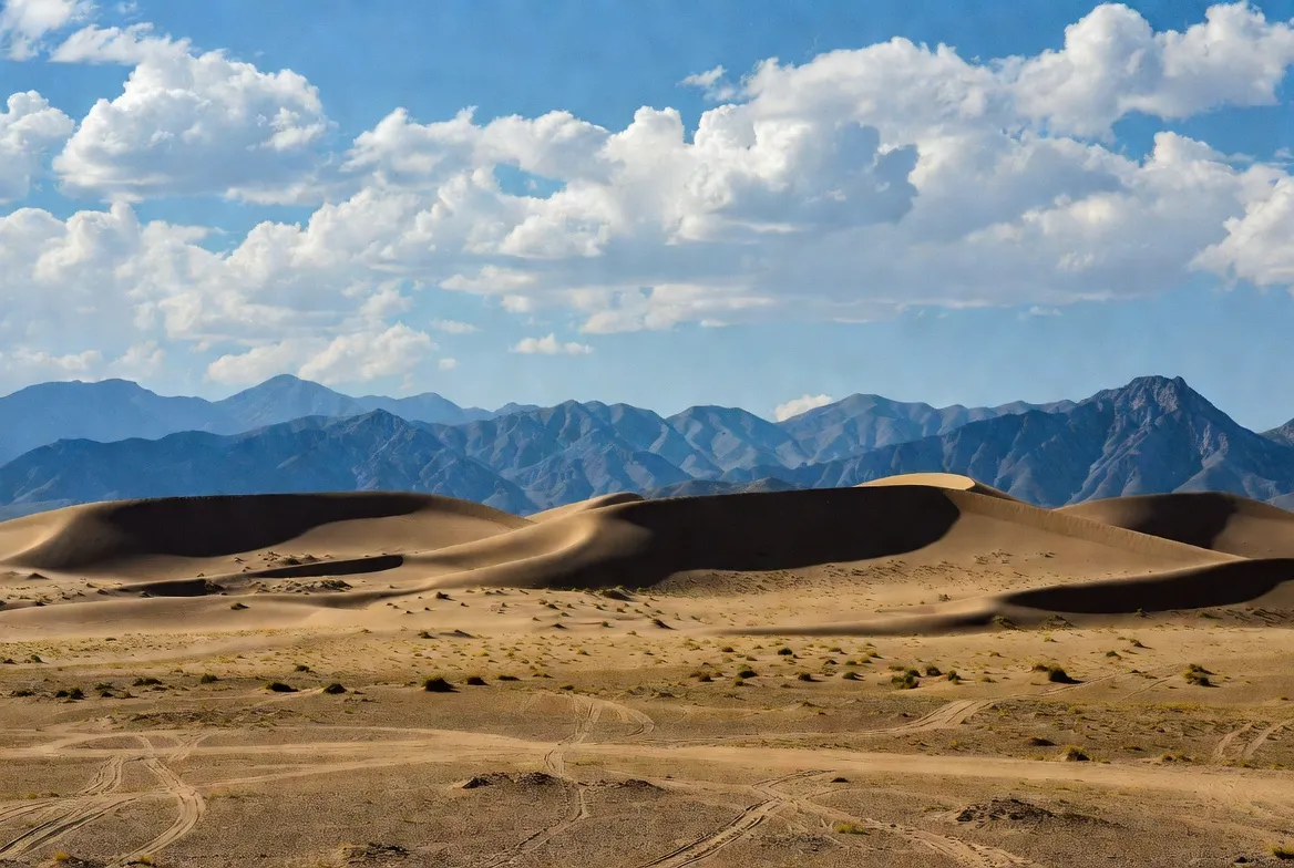
1–3 day sampler: Khongoryn Els loop
- Start/End: Dalanzadgad → Khongoryn Els → Yoliin Am → return.
- Highlights: dunes, short dune climbs, ger stays.
- Vehicle: 4×4 recommended; soft sand requires airing down tyres.
- Download: khongoryn-els-3day.gpx.
- Top tip: approach dunes early morning or late afternoon for best sand stability & light.
4–7 days: Flaming Cliffs + Nemegt Basin
- Start/End: Dalanzadgad → Bayanzag (Flaming Cliffs) → Nemegt Basin → return.
- Highlights: dinosaur bonebeds, remote badlands, and photography.
- Download: flaming-cliffs-nemegt-7day.gpx.
- Rules: do not dig or remove fossils — report finds to museums/authorities. Flaming Cliffs are historically important paleontological localities (first dinosaur egg finds, multiple type specimens).
8–14 days: South Gobi extended expedition
- Route: mixed sealed roads and long untracked sections; includes Baga Gazriin Chuluu, Yolyn Am.
- Highlights: deep night skies, varied landscapes, and Wildlife chances.
- Download: south-gobi-14day.gpx.
- Safety: satellite phone, extra fuel, heavy-duty spares required. Dalanzadgad is the last significant service town before the extended remote sections.
Places of interest — SOP-style primers
Key places
- Khongoryn Els
- Flaming Cliffs (Bayanzag)
- Nemegt Basin
- Yolyn Am
- Baga Gazriin Chuluu
- Dalanzadgad
- Gurvan Saikhan
- Mongolian National Tourism Board
Each of the named POIs above has a corresponding polygon or point record in gobi_pois.geojson. Sensitive fossil sites are redacted or generalised to approximate_viewing_area in the sensitivity_level field.
Short primers (structured for copy into CMS sections):
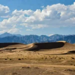
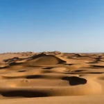
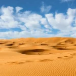
- Khongoryn Els — the Singing Dunes
Long dune field with dynamic morphology. Use the Khongoryn-els GPX to locate serviceable approach tracks; dunes change year-to-year, tracks drift, and soft sand is common. - Flaming Cliffs (Bayanzag) & Nemegt Basin — fossil badlands
Famous for dinosaur eggs and early 20th-century expeditions, the cliffs are scientifically sensitive. The Flaming Cliffs layer includes permitted viewing areas and museum contacts rather than exact dig coordinates. - Yolyn Am — the ice canyon
A narrow gorge in Gurvan Saikhan that historically held persistent ice. The ice patch has been diminishing, but it remains a notable microclimate stop. - Baga Gazriin Chuluu — granite outcrops
Dramatic rock outcrops rising from the steppe; good for short hikes and photography. (Layer: rock_outcrop with access_notes.)
Landscape, flora & fauna — feature lists
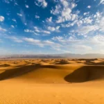
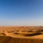
Landscape types (as labels): erg (sand sea), badland, gorge, outcrop, gravel_plain, salt_pan.
Flora: xerophytic shrubs, halophytes near pans, seasonal grasses.
Fauna: wild Bactrian camel (occurrence: rare), argali, saiga (seasonal), lammergeier and raptors in gorges. Use the observations/ folder to store vetted wildlife sightings (observer, date, photo_url) for reproducible claims.
Survival tips & field checklist
Vehicle & navigation
- 4×4 with dual spare wheels. Recovery gear: snatch strap, hi-lift jack, shovel. Satellite comms (SPOT, InReach).
- Fuel: carry 30–50% extra beyond mapped fuel points.
Water & food
- Plan 4–6 L / person/day for active travel. Bring water purification & potable jerry cans.
Clothing & personal gear
- Layering kit, sun protection, sturdy boots, and a headlamp.
Emergency
- Trauma first aid kit, broad-spectrum antibiotics (check local medical guidance), and evacuation plan.
Permits
- Check protected area permits for Flaming Cliffs / Nemegt. Local rules often forbid fossil removal.
Table — Best times to visit & expected conditions
| Period | Temperature | Conditions | Notes |
| Apr–Jun | 5–25°C | Cool spring, good for travel | Roads improving; steppe blooms |
| Jul–Aug | 20–40°C | Hot; summer storms possible | Some tracks muddy after rain |
| Sep–Oct | 5–25°C | Crisp autumn, excellent light | Prime for photography & camps |
| Nov–Mar | −30 → 0°C | Harsh winter | Many roads are impassable; only expert teams |
Quick examples
- Load GeoJSON in QGIS: Layer → Add Layer → Add Vector Layer → choose gobi_roads.geojson.
- Import GPX to Garmin: Copy *.gpx to Garmin\NewFiles and restart the device.
- Embed web map: Use the Tiny Leaflet embed shown earlier, and load gzipped GeoJSON via CDN.
Ethics & local engagement
- Do not remove fossils. Report findsforo accredited museums.
- Respect herder camps and request permission before photographing people. Compensate for cultural experiences.
- Consider sharing revenue or direct donations with local museums or conservation projects.
FAQs
A: Yes — many parts are drivable by experienced 4×4 drivers. Use the GPX tracks, plan fuel/water, and carry satellite comms. For remote sections, hire a local driver or guide.
A: GPX is best for handheld GPS and car navigation apps. GeoJSON is best for web overlays and QGIS.
A: No. Removing fossils is illegal in Mongolia. Report findings to local authorities or accredited museums.
A: Use the attribution line in the README (example: “Gobi Map Pack — data by [Your Site], CC-BY-NC”).
Pros & Cons
Pros
- Fills the gap between travel articles and raw GIS datasets.
- High backlink potential (research groups, museums, travel sites).
- Useful for both self-drive travellers and scientists.
Cons
- Requires ongoing verification of field data (waterpoints, fuel).
- Sensitive fossil data must be redacted.
- Large file hosting needed (A0 PDFs, zipped GeoJSON).
Conclusion
Publish this pack with explicit licenses, checksum-backed provenance, and local Engagement (logistics hub: Dalanzadgad; stakeholder contact: Mongolian National Tourism Board). That combination of field-tested routes, machine-readable schemas and ethical guidance makes the dataset both immediately useful in the field and highly citable for research, outreach, and long-term conservation work.